We are in the process of migrating all NASA Earth science data sites into Earthdata from now until end of 2026. Not all NASA Earth science data and resources will appear here until then. Thank you for your patience as we make this transition.
Read about the Web Unification Project
Filters

Listing of ESDS program elements AGU sessions, posters, elightning talks and workshops for the Hybrid Fall AGU 2021 Annual Meeting.
Feature Article
Feb. 1, 2022

Image captured on Jan 15, 2022, by the ABI instrument aboard the GOES-West satellite.
Worldview Image of the Week
Feb. 1, 2022

Data from NASA’s ORNL DAAC helps scientists like Dr. Kevin Schaefer detect climate-induced thawing of permafrost throughout the Arctic.
Data User Story
Jan. 31, 2022
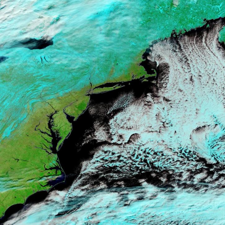
Image captured Jan 30, 2022, by the MODIS instrument aboard the Terra satellite.
Worldview Image of the Week
Jan. 31, 2022
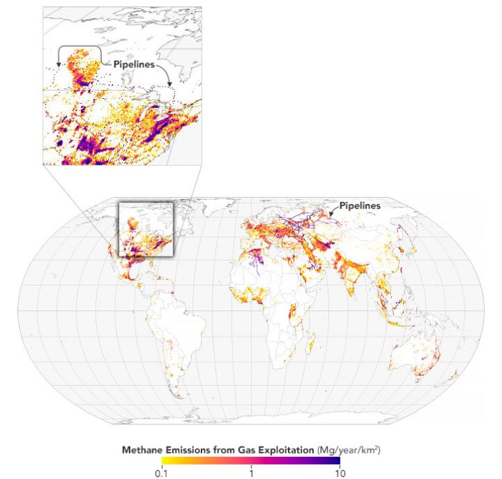
Scientists map 97 million metric tons of methane emissions from the exploitation of oil, natural gas, and coal.
Feature Article
Jan. 31, 2022

Launched September 27, Landsat 9 will provide a high-quality and reliable stream of land imaging data for the next 10-plus years.
Feature Article
Jan. 31, 2022

An opportunity for stakeholders to provide input on ways to improve the usability of NASA airborne and field data.
Event
Jan. 31, 2022
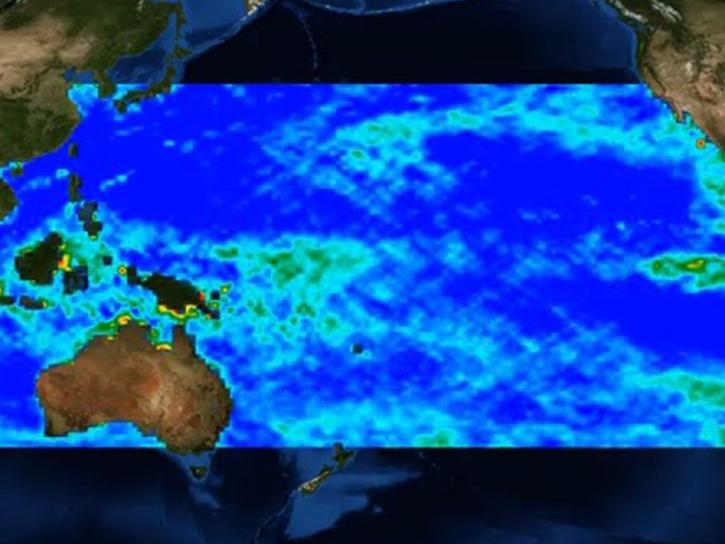
Researchers are using satellite data and machine learning to map microplastic concentrations across the ocean.
Feature Article
Jan. 31, 2022
SHOWING 8 OF 2379