Delivery of Suomi National Polar-orbiting Partnership (Suomi NPP) satellite data products will cease on November 1, 2026. Data users should transition now to alternative products from NOAA-21 and NOAA-20.
Suomi NPP data announcement
Typhoon Krosa in the Philippine Sea
Image captured on 12 August 2019, by the VIIRS instrument, aboard the joint NASA/NOAA Suomi NPP satellite.
Image
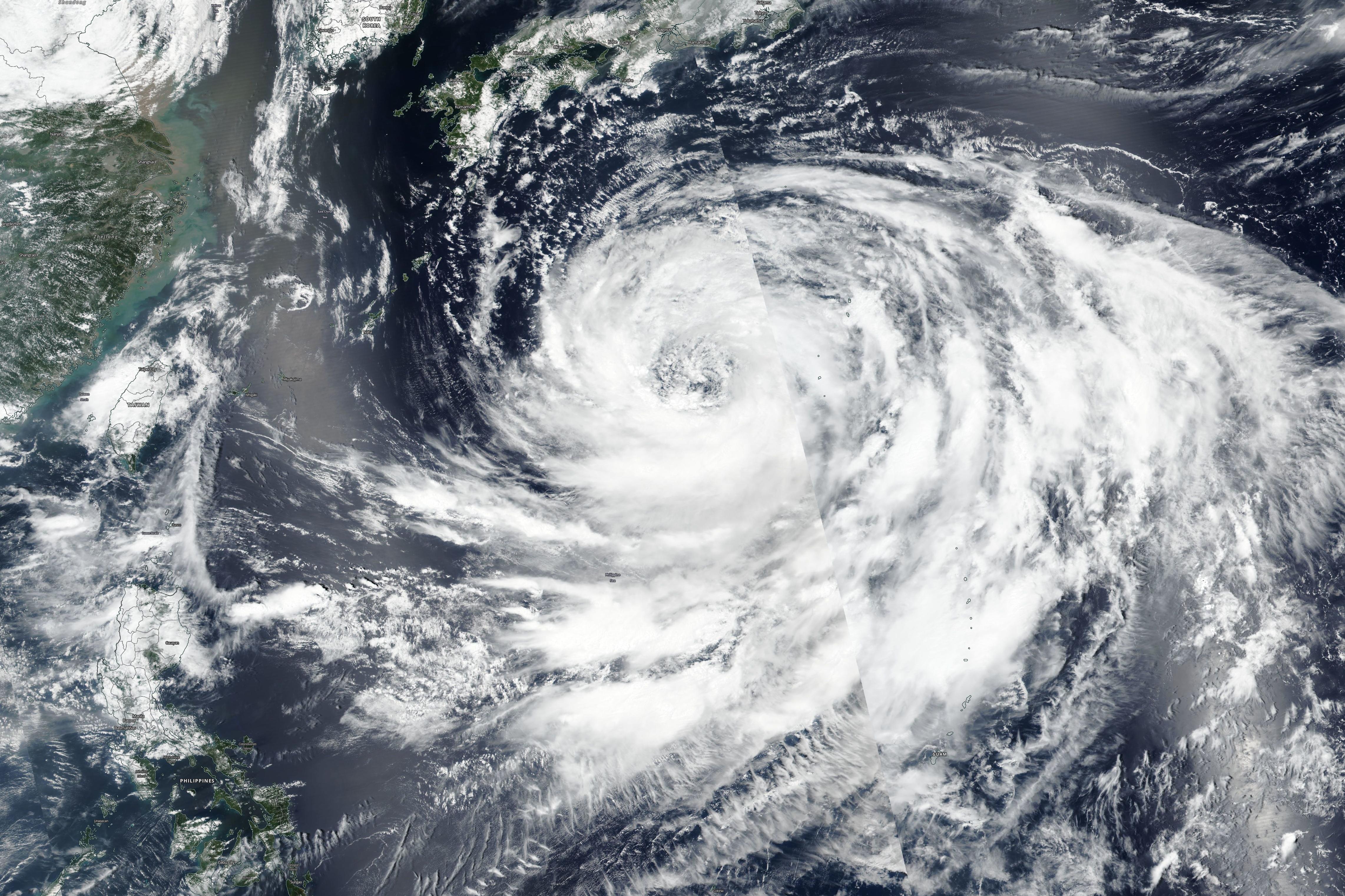
This true-color image shows Tropical Krosa in the Philippine Sea, acquired on 12 August 2019 by the Visible Infrared Imaging Radiometer Suite (VIIRS) instrument, aboard the joint NASA/NOAA Suomi National Polar-orbiting Partnership (Suomi NPP) satellite. NASA imagery revealed that the large typhoon has a large eye (40 nautical miles wide, captured on 9 August 2019 by the Atmospheric Infrared Sounder (AIRS) instrument about NASA's Aqua satellite).
Visit Worldview to visualize near real-time imagery from NASA's Earth Observing System Data and Information System (EOSDIS).
Details
Last Updated
Published on
Nov. 4, 2020