Delivery of Suomi National Polar-orbiting Partnership (Suomi NPP) satellite data products will cease on November 1, 2026. Data users should transition now to alternative products from NOAA-21 and NOAA-20.
Suomi NPP data announcement
Sivash, Crimean Peninsula
Image captured on 28 June 2020, by the MODIS instrument, aboard the Aqua satellite.
Image
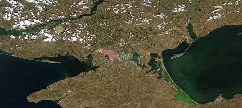
True color corrected reflectance image of the Sivash, Crimean Peninsula. The image was acquired on 28 June 2020 by the Moderate Resolution Imaging Spectroradiometer (MODIS) instrument, aboard the Aqua satellite.
The Sivash are a network of shallow lagoons, the deepest being no more than 3 meters deep. In the summer months, the warm waters give off a smell, giving them the nickname of "Putrid Sea" or "Rotten Sea". Some of the lagoons are different colors due to the salt tolerant algae in the water, with the pink lagoons being most visible in the image above.
Visit Worldview to visualize near real-time imagery from NASA's EOSDIS, and check out more Worldview weekly images in our archive.
Details
Last Updated
Published on
Aug. 31, 2020