Delivery of Suomi National Polar-orbiting Partnership (Suomi NPP) satellite data products will cease on November 1, 2026. Data users should transition now to alternative products from NOAA-21 and NOAA-20.
Suomi NPP data announcement
Severe storms across the United States
Image captured on 18 August 2019, by the VIIRS instrument, aboard the joint NASA/NOAA Suomi NPP satellite, with IMERG data showing Rain Rate (Early).
Image
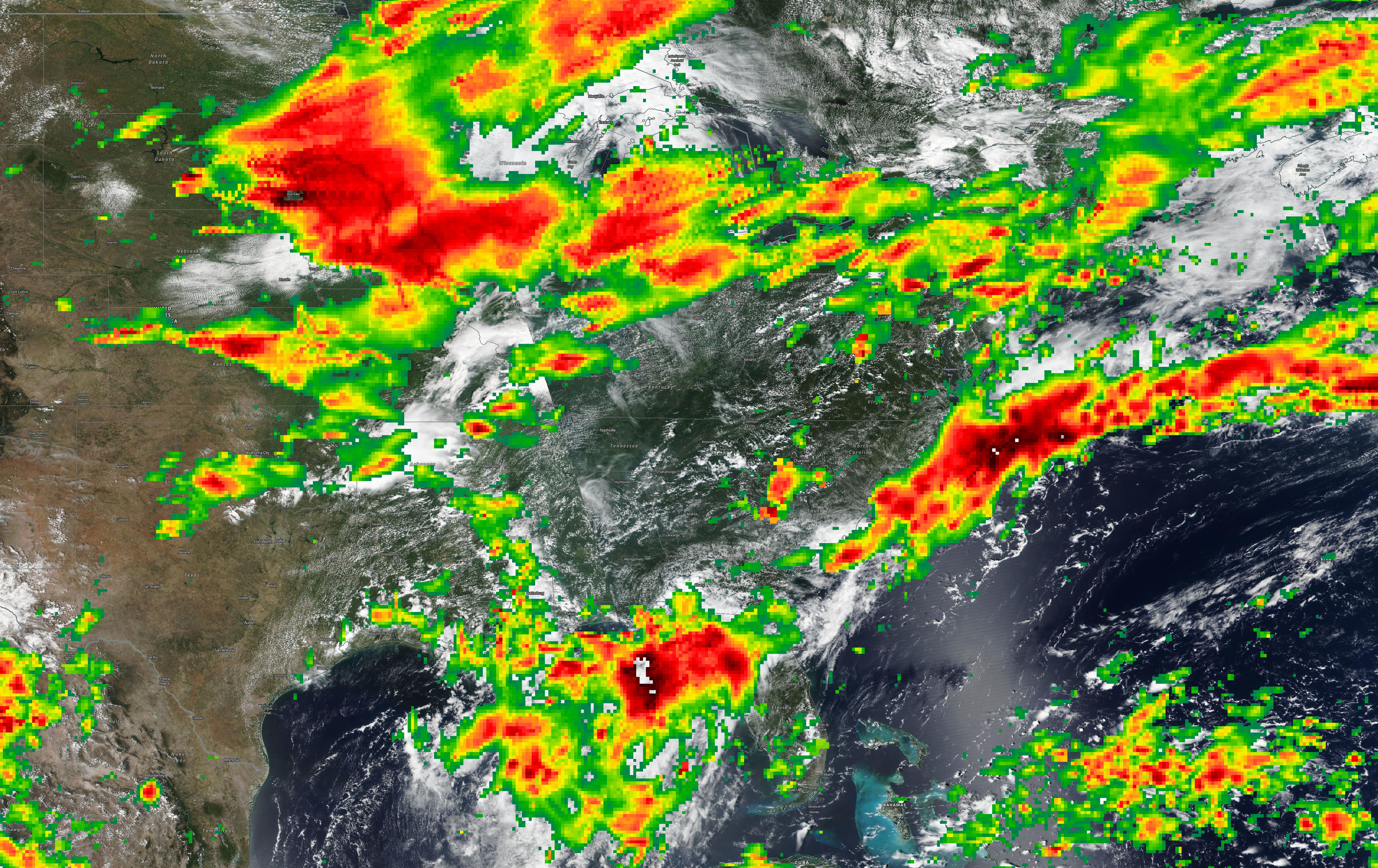
This image shows Severe Storms across the United States, acquired on 18 August 2019 by the Visible Infrared Imaging Radiometer Suite (VIIRS) instrument, aboard the joint NASA/NOAA Suomi National Polar-orbiting Partnership (Suomi NPP) satellite. Also shown is Integrated Multi-satelliE Retrievals for Global Precipitation Measurement (IMERG) data showing Rain Rate (Early); areas with red/orange color are heavier rates of rain.
Visit Worldview to visualize near real-time imagery from NASA's Earth Observing System Data and Information System (EOSDIS).
Details
Last Updated
Published on
Sept. 11, 2020