Delivery of Suomi National Polar-orbiting Partnership (Suomi NPP) satellite data products will cease on November 1, 2026. Data users should transition now to alternative products from NOAA-21 and NOAA-20.
Suomi NPP data announcement
Mississippi River, USA
Image captured on 31 May 2020, by the MODIS instrument, aboard the Terra satellite.
Image
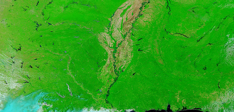
False color corrected reflectance image of the Mississippi River, USA. The image was acquired on 31 May 2020 by the Moderate Resolution Imaging Spectroradiometer (MODIS) instrument, aboard the Terra satellite.
This False color (Bands 7-2-1) image is useful for enhancing floods and waterways. Water appears dark blue or black, bare ground/fields without vegetation are shown in brown, and vegetation in bright green.
Visit Worldview to visualize near real-time imagery from NASA's EOSDIS, and check out more Worldview weekly images in our archive.
Details
Last Updated
Published on
June 8, 2020