Delivery of Suomi National Polar-orbiting Partnership (Suomi NPP) satellite data products will cease on November 1, 2026. Data users should transition now to alternative products from NOAA-21 and NOAA-20.
Suomi NPP data announcement
Great Barrier Reef, Australia—December 2015
Image captured on 20 December 2015 by the MODIS instrument, aboard NASA's Terra satellite.
Image
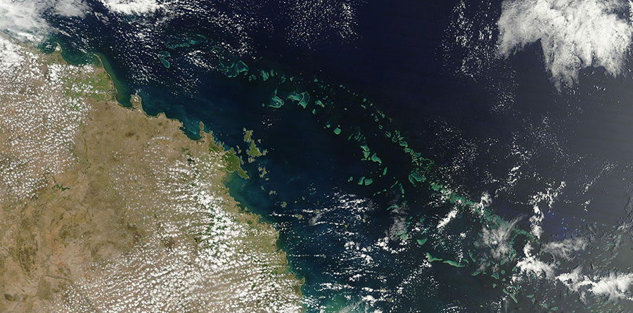
Image of the Great Barrier Reef, off the eastern coast of Australia acquired on 20 December 2015 by the Moderate Resolution Imaging Spectroradiometer (MODIS) sensor aboard NASA's Terra satellite. The Great Barrier Reef is the world's largest coral reef system, comprised of over 2,900 individual coral reefs and 900 islands. The Great Barrier Reef stretches about 2,300 kilometers (1,400 mi) in length and covers an area of approximately 344,400 square kilometers (133,000 sq mi).
Visit Worldview to visualize near real-time (NRT) data from Earth Observing System Data and Information System (EOSDIS).
Sources: Great Barrier Reef. UNEP World Conservation Monitoring Centre
Details
Last Updated
Published on
Sept. 11, 2020