Delivery of Suomi National Polar-orbiting Partnership (Suomi NPP) satellite data products will cease on November 1, 2026. Data users should transition now to alternative products from NOAA-21 and NOAA-20.
Suomi NPP data announcement
Expansion of the Suez Canal, Egypt
Image captured by the MODIS instrument on 10 August 2015, aboard the Terra satellite.
Image
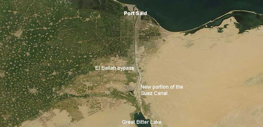
Image of a new portion of the Suez Canal in Egypt. This image was captured by the Moderate Resolution Imaging Spectroradiometer (MODIS) instrument aboard the Terra satellite on 10 August 2015. The recently inagurated portion of the Suez Canal covers 72km (45 miles) which includes the canal shown above and deepened and widened sections of the Great Bitter Lakes bypasses and El Ballah bypass. Compare the 10 August 2015 image to one from 14 August 2014.
Visit Worldview to visualize near real-time data from NASA's Earth Observing System Data and Information System (EOSDIS).
Sources: Suez Canal Authority. New Suez Canal; CNN. Egypt inagurates Suez Canal Expansion.
Details
Last Updated
Published on
Sept. 11, 2020