Delivery of Suomi National Polar-orbiting Partnership (Suomi NPP) satellite data products will cease on November 1, 2026. Data users should transition now to alternative products from NOAA-21 and NOAA-20.
Suomi NPP data announcement
Chesapeake Bay, USA—2020
Image captured on 10 May 2020, by the MODIS instrument, aboard the Aqua satellite.
Image
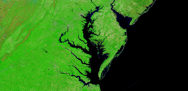
False color (Bands 7-2-1) corrected reflectance image of the Chesapeake Bay, USA. The Chesapeake Bay estuary is located in the states of Maryland and Virginia. The image was acquired on 10 May 2020 by the Moderate Resolution Imaging Spectroradiometer (MODIS) instrument, aboard the Aqua satellite.
The Bands 7-2-1 combination shows water as very dark because it absorbs in red (Band 1) and shortwave infrared (Band 7). Vegetation is very reflective in the near infrared (Band 2), and absorbent in Band 1 and Band 7. Assigning that band to green means even the smallest hint of vegetation will appear bright green in the image.
Visit Worldview to visualize near real-time imagery from NASA's EOSDIS, and check out more Worldview weekly images in our archive.
Details
Last Updated
Published on
Sept. 11, 2020