
Selected Historical ASF Datasets Moving to Request-Only Access

Starting October 1, 2026, some historical ASF SAR datasets will be available only by request, not through regular search and download tools.

Beginning October 1, 2026, several historical synthetic aperture radar (SAR) datasets held by the Alaska Satellite Facility will be available only by request. They will no longer be available through ASF’s regular data search and download tools.

The change applies to the following datasets:

  • ERS-1 (August 8, 1991 – September 29, 1997): Radar images used to study land, oceans, and ice; collected by the European Space Agency’s (ESA) first European Remote Sensing (ERS) satellite. 
  • ERS-2 (October 1, 1995 – July 4, 2011): Radar images used to study polar ice, oceans, land, and changes on Earth’s surface; also operated by ESA. 
  • JERS-1 (May 20, 1992 – October 11, 1998): Radar images used to map forests, wetlands, and other land areas around the world; Japanese Earth Resources Satellite 1 (JERS-1, also known as FUYO-1) was operated by the Japan Aerospace Exploration Agency (JAXA). Users can find and download Level 0 and Level 2.1 JERS-1 data from JAXA’s G-Portal.
  • RADARSAT-1 (February 1, 1996 – March 17, 2009): Radar images used to study sea ice, floods, wetlands, forests, and changes on Earth’s surface; operated by the Canadian Space Agency (CSA). These products are also available through the CSA Open Data Portal.

Users looking for data from any of these satellites may also find that ESA, JAXA, and CSA offer newer processing or other versions of the data.
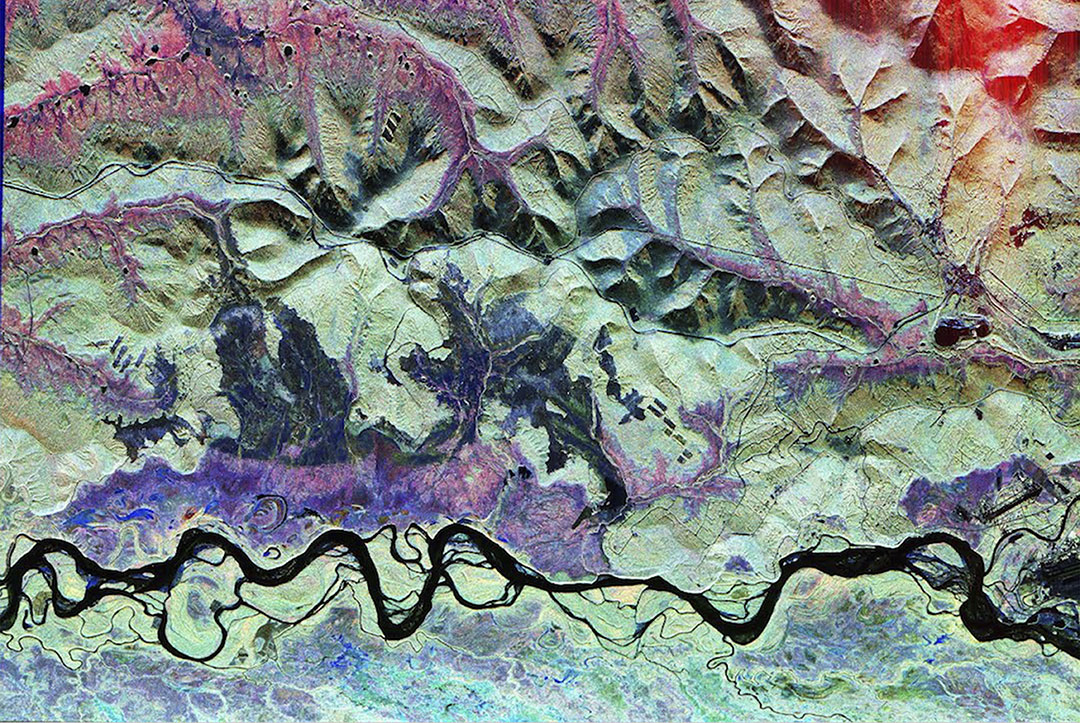
Image
Image Caption

1993 AIRSAR imagery of Bonanza Creek, Yukon Territory Canada.

The following datasets will be temporarily unavailable online. The specific date at which they will become available again online is to be determined:

  • AIRSAR (1998–2004): Airborne SAR data collected at select locations.
  • GISMO (2006–2008): Airborne radar data collected over Greenland to measure the ice sheet’s surface, thickness, and the land beneath the ice.
  • Glacier Speed (winters from 2007–2010): Maps that showed how fast many of Alaska’s glaciers were moving. The maps were made from ALOS PALSAR radar images.
  • RAMP (September 9–October 20, 1997, and September 3–November 17, 2000): RADARSAT-1 maps of Antarctica created to study the ice sheet, coastline, and movement of the ice.
  • Sea Ice MEaSUREs (1995–2011): Maps and measurements showing how sea ice moved and changed across the Arctic Ocean and Southern Ocean.
  • Wetlands MEaSUREs (1993–2009): Maps showing where wetlands and surface water were found, the types of plants present, and how flooded areas changed over time.

To request any of these data, email ASF User Services. Please include the name of the dataset, describe the needed geographic area, and provide a date range for your request.

Referenced Datasets

Dataset Name Format
RADARSAT-1 Level 1 Product

Details

Last Updated

Oct. 2, 2026

Published

Oct. 2, 2026

Data Center/Project

Alaska Satellite Facility DAAC (ASF DAAC)