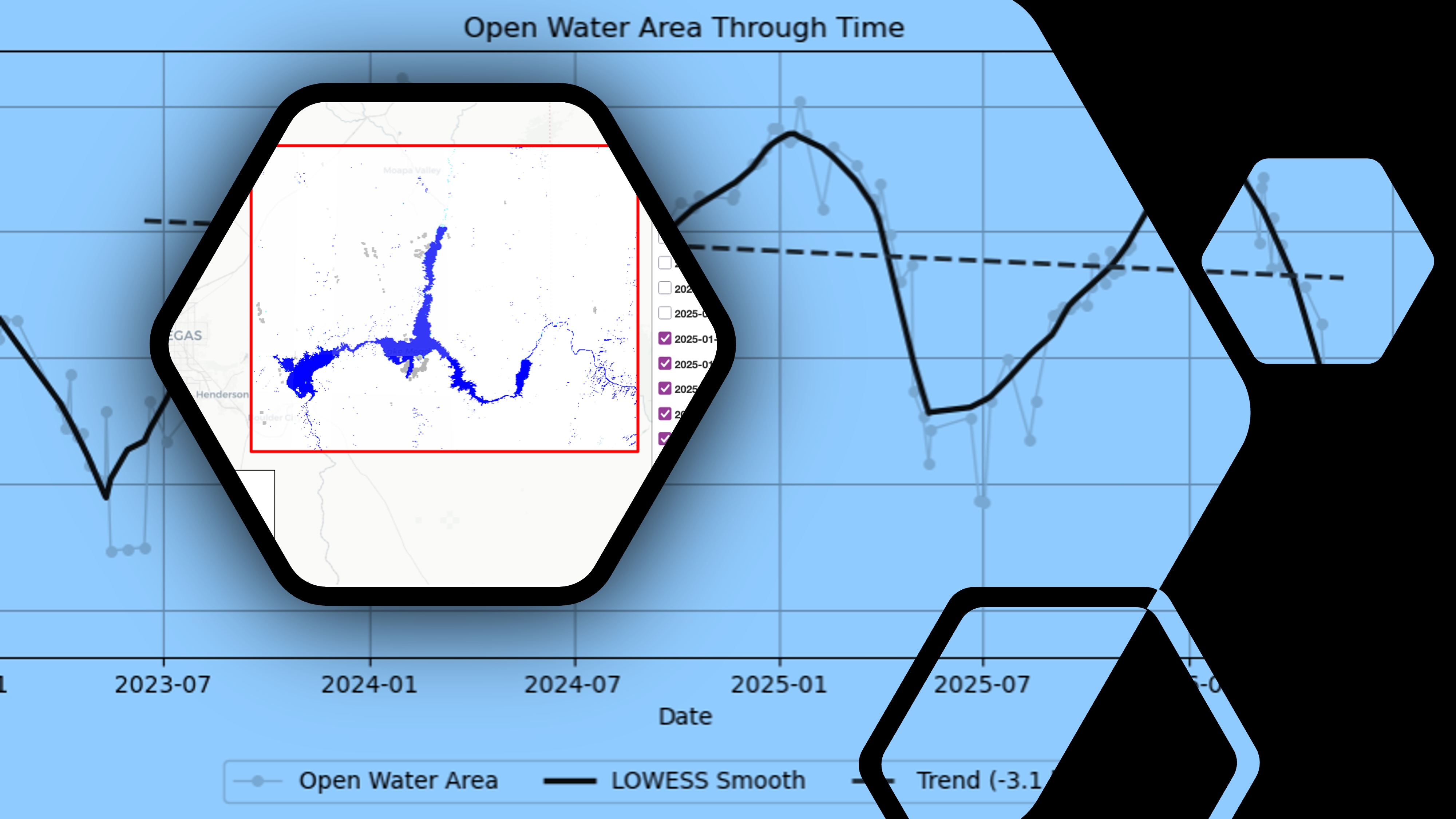
NASA’s Physical Oceanography Distributed Active Archive Center (PO.DAAC) announced the availability of the NASA Earthdata GIS (EGIS) image services for the OPERA Dynamic Surface Water Extent from Harmonized Landsat Sentinel-2 product (Version 1) collection—specificly for the B01_WTR and B03_CONF layers.
The new OPERA Dynamic Surface Water Extent (DSWx) services provide a simple way to access the OPERA DSWx-HLS surface water record without downloading and managing large datasets locally. Users can request only the geographic area and time period they need, integrate the data directly into GIS applications or Python workflows, and analyze multi-year trends while letting the service deliver only the data required for their analysis.
The services are available as both ArcGIS REST image service endpoints, as well as Open Geospatial Consortium (OGC) endpoints:
To help the research community get started, the science team has assembled two new tutorials, along with a GIS applications access guide:
- Earthdata GIS OPERA DSWx-HLS Image Service Access - Programmatic shows how to connect to the OPERA DSWx HLS service using Python and then interactively explore and visualize the data without the need for downloading.
- Earthdata GIS OPERA DSWx-HLS Science Use Case: Analyzing Surface Water Extent Change at Lake Mead demonstrates an end-to-end scientific workflow for analyzing changes in Lake Mead's surface water extent over time using the EGIS service and OPERA DSWx-HLS data, including raster export, mosaicking, quality filtering, and trend analysis.
- Earthdata GIS OPERA DSWx-HLS Image Service Access shows how to connect to the OPERA DSWx HLS service using GIS applications.
Whether you're studying floods, droughts, or changing surface water systems, these resources provide a practical starting point for incorporating OPERA DSWx-HLS data into your own analyses.
If you have feedback on these services, please provide them via the PODAAC GIS Services Survey.
For other NASA EGIS services and resources, visit Earthdata GIS or GIS at NASA.