We are in the process of migrating all NASA Earth science data sites into Earthdata from now until end of 2026. Not all NASA Earth science data and resources will appear here until then. Thank you for your patience as we make this transition.
Read about the Web Unification Project
Filters

With the State of the Ocean tool, visualizing ocean data is just a web browser away.
Feature Article
July 28, 2023
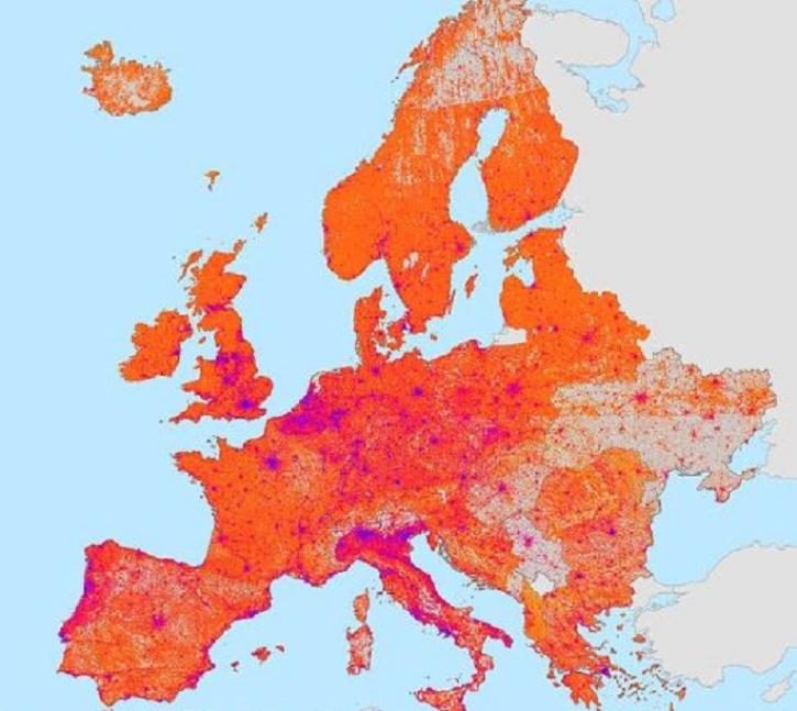
The Global Gridded Relative Deprivation Index is the first product of its kind to cover the world at a 1-kilometer resolution.
Feature Article
July 13, 2023
A NASA/Rensselaer Polytechnic Institute collaboration is teaching students how to use NASA Earth observation data.
Feature Article
July 11, 2023

Terrestrial Ecology Subsetting and Visualization Services (TESViS) supports ecological field research in easy-to-use formats.
Feature Article
June 30, 2023

Data from aircraft and other platforms help validate satellite sensors and advance science and computer modeling.
Feature Article
June 28, 2023
New surface water extent and surface disturbance products from a NASA effort are providing needed resources to federal agencies.
Feature Article
June 15, 2023
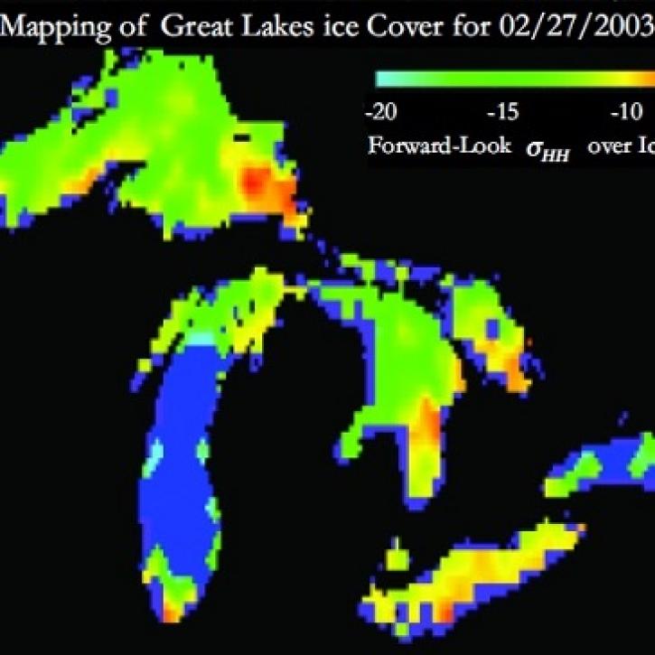
Understanding Great Lakes ice means enduring some tough conditions.
Feature Article
June 2, 2023

The SeaWiFS Bio-optical Archive and Storage System (SeaBASS) offers data for satellite validation, algorithms, and open science.
Feature Article
June 1, 2023
SHOWING 8 OF 534