We are in the process of migrating all NASA Earth science data sites into Earthdata from now until end of 2026. Not all NASA Earth science data and resources will appear here until then. Thank you for your patience as we make this transition.
Read about the Web Unification Project
Filters

Dr. Don McNeil at Prince of Songkla University in Thailand uses NASA Earth observing data and tools to teach his students about the natural world.
Feature Article
Nov. 4, 2020
Global carbon monoxide data from the MOPITT instrument aboard NASA’s Terra satellite are the newest near real-time products available through the Land, Atmosphere Near real-time Capability for EOS (LANCE).
Feature Article
Nov. 4, 2020
The dataset, which is part of NASA’s Arctic Boreal Vulnerability Experiment (ABoVE), enables comparisons of changes in surface water extent spanning 20 years.
Feature Article
Nov. 4, 2020

The FTP protocol for data and information access at NASA’s PO.DAAC is retired and has been replaced with PO.DAAC Drive.
Feature Article
Nov. 4, 2020
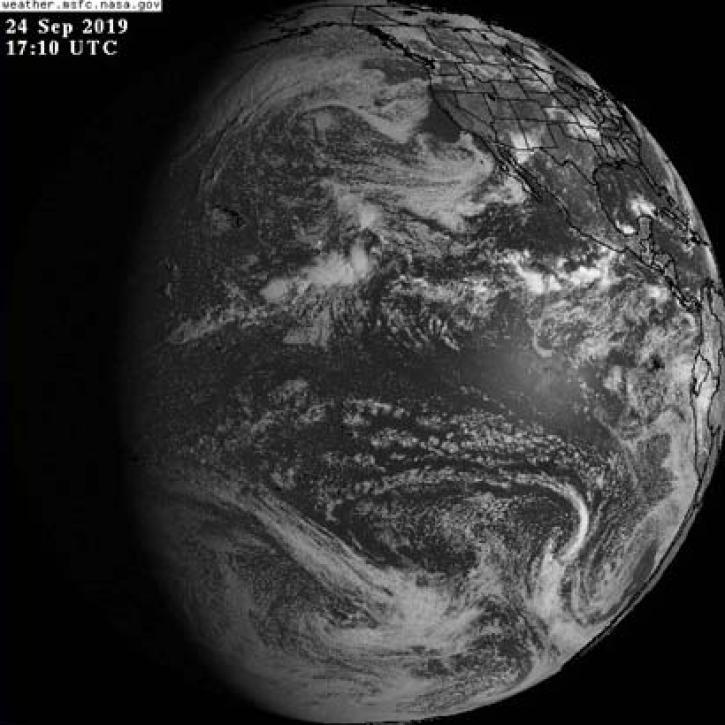
The addition of GOES-East, GOES-West, and Himawari-8 geostationary imagery updated every 10 minutes lets you view Earth as it is “right now.”
Feature Article
Nov. 4, 2020

NASA’s Land, Atmosphere Near Real-time Capability for Earth observations, better known as LANCE, is 10 years old. Here’s a look at 10 LANCE milestones over the past decade.
Feature Article
Nov. 4, 2020

Sensors aboard Earth observing satellites and NASA’s Fire Information for Resource Management System (FIRMS) provide information about wildfires 24/7 to anyone, anywhere in the world.
Feature Article
Nov. 4, 2020

High-resolution sea surface temperature data can be used to study marine heat waves and the health of marine ecosystems.
Feature Article
Nov. 4, 2020
SHOWING 8 OF 534