Earth Observation Data Basics

The life cycle of Earth observation data is rich and complex, with many points of entry along the pipeline. From collection to visualization, we dive deep into the basics to demystify the incredible data in our catalog.

Remote Sensing

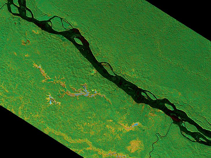
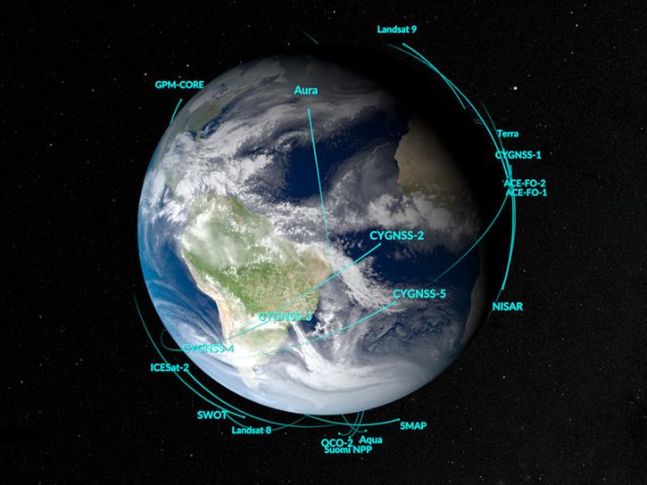
Remote sensing is the acquiring of information from a distance. NASA observes Earth and other planetary bodies via remote instruments on space-based platforms (e.g., satellites or spacecraft) and on aircraft that detect and record reflected or emitted energy. Remote instruments, which provide a global perspective and a wealth of data about Earth systems, enable data-informed decision making based on the current and future state of our planet.

For more information, check out the Fundamentals of Remote Sensing training from the Applied Remote Sensing Training (ARSET) program.
Get Data

Explore the world’s largest repository of open-access Earth science data.

Remote Sensing Data Basics

Understanding Metadata

This interactive tool helps users navigate and understand essential metadata on our Earth science dataset landing pages. Through guided examples and hands-on exploration, learn critical context about our data to aid you in your own scientific discoveries.
Interactive

Parts of the Earthdata Dataset Landing Page

Explore
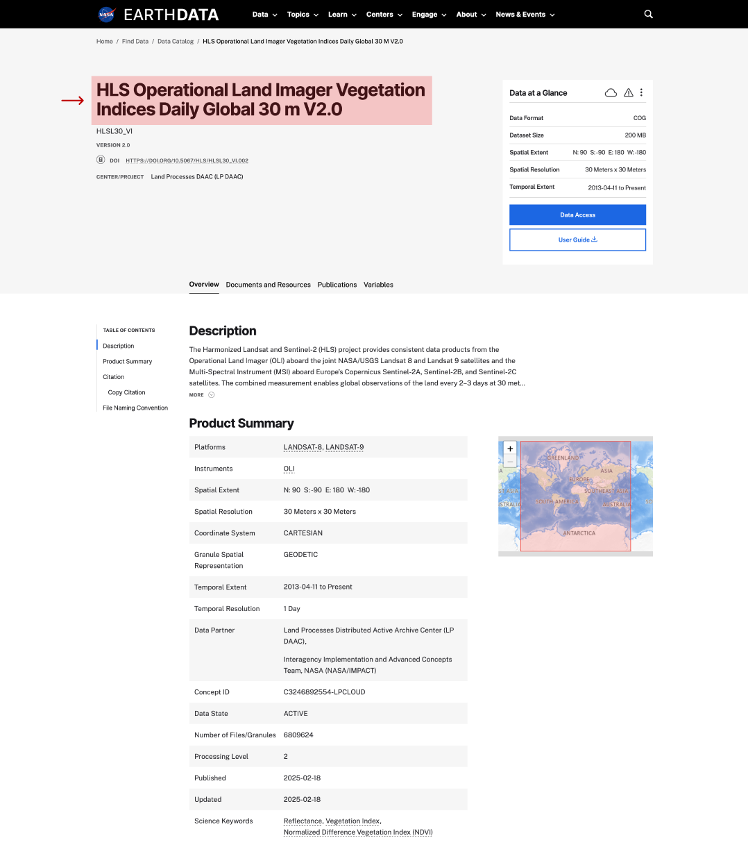
long name on dataset page
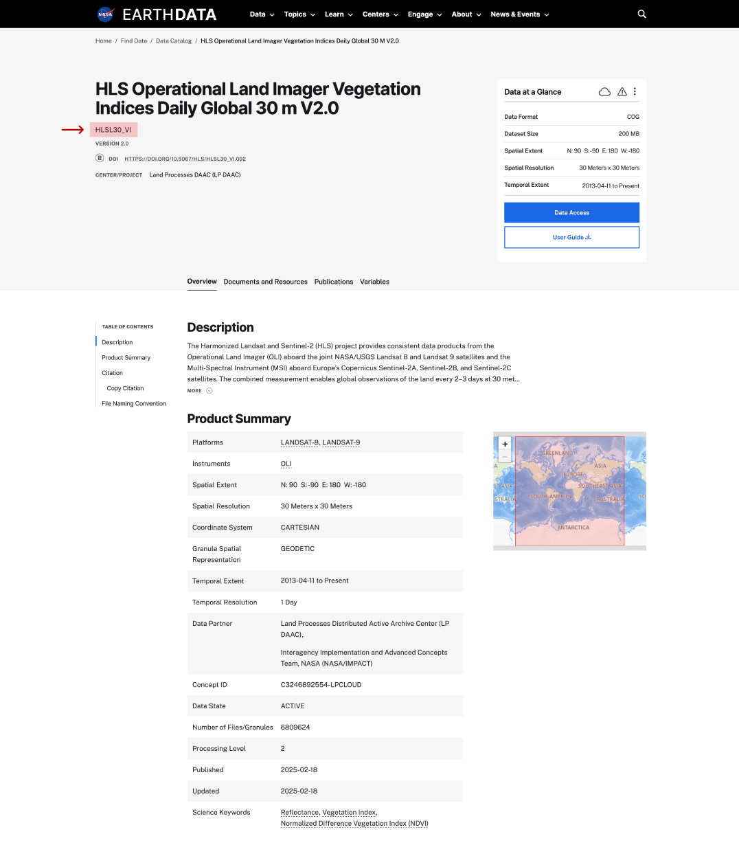
short name on dataset page
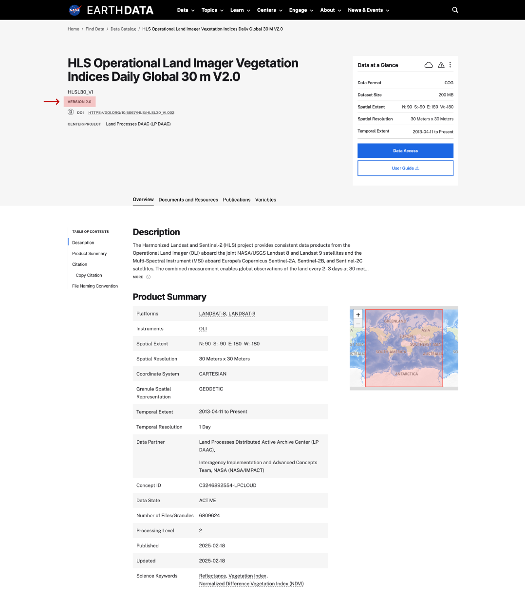
version on dataset page
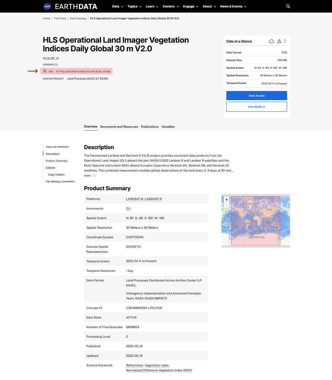
DOI on dataset page
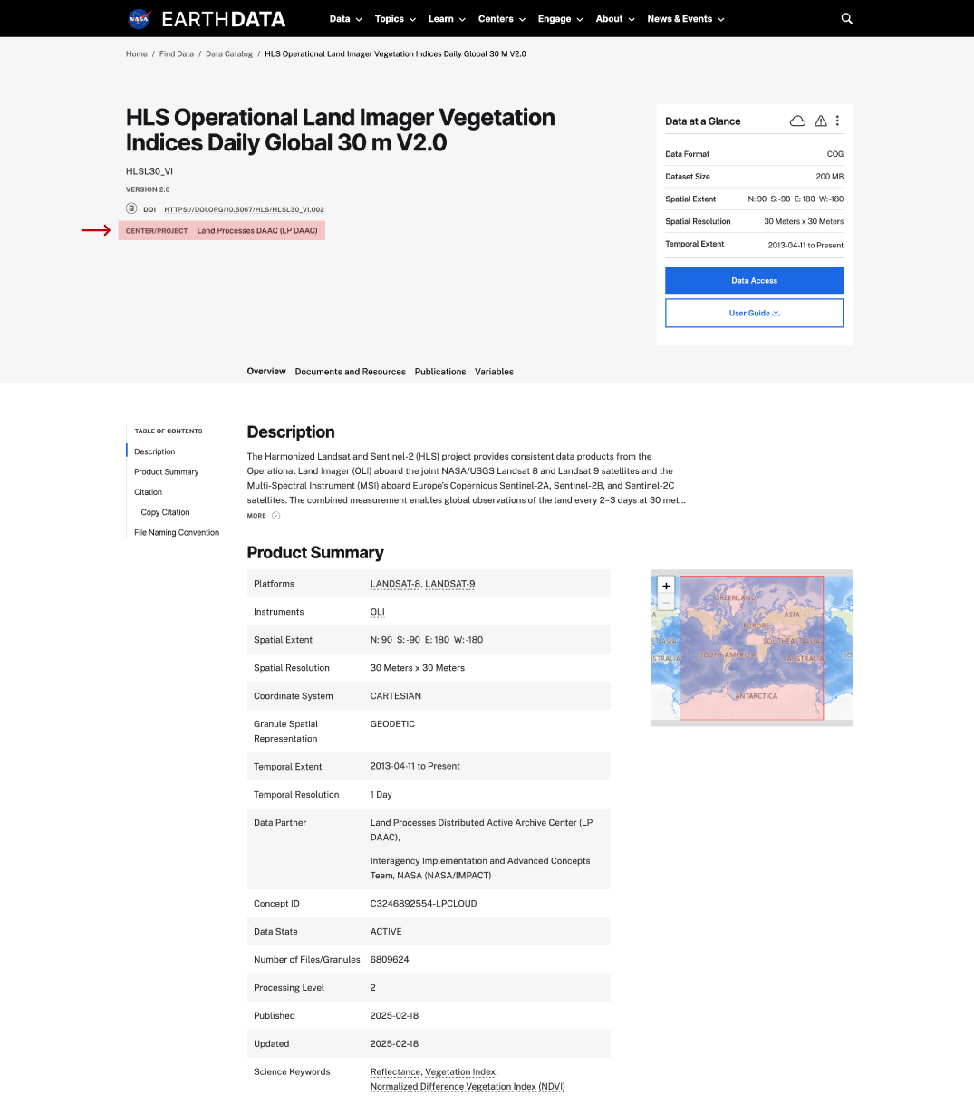
center/project on dataset page
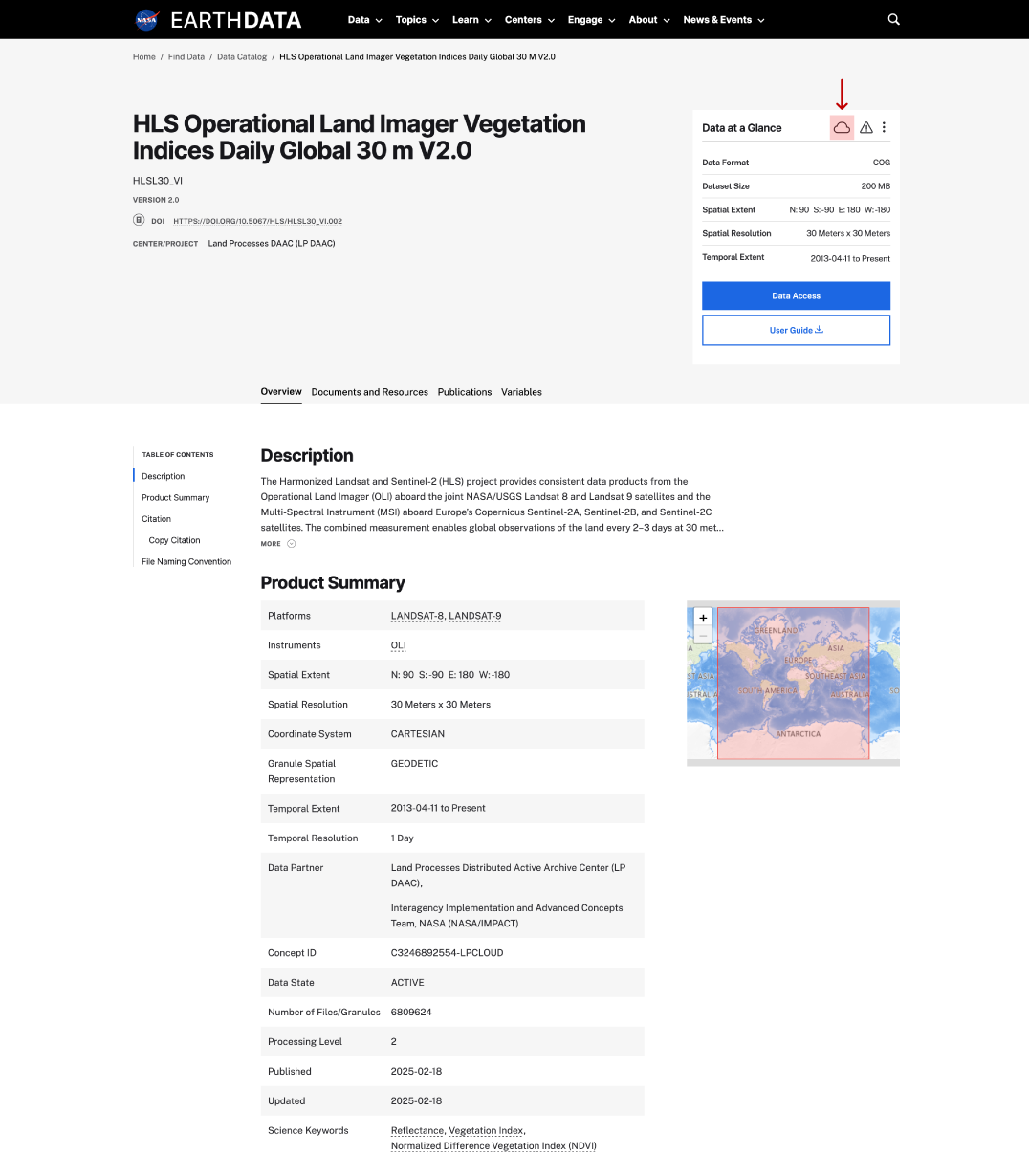
cloud icon on dataset page
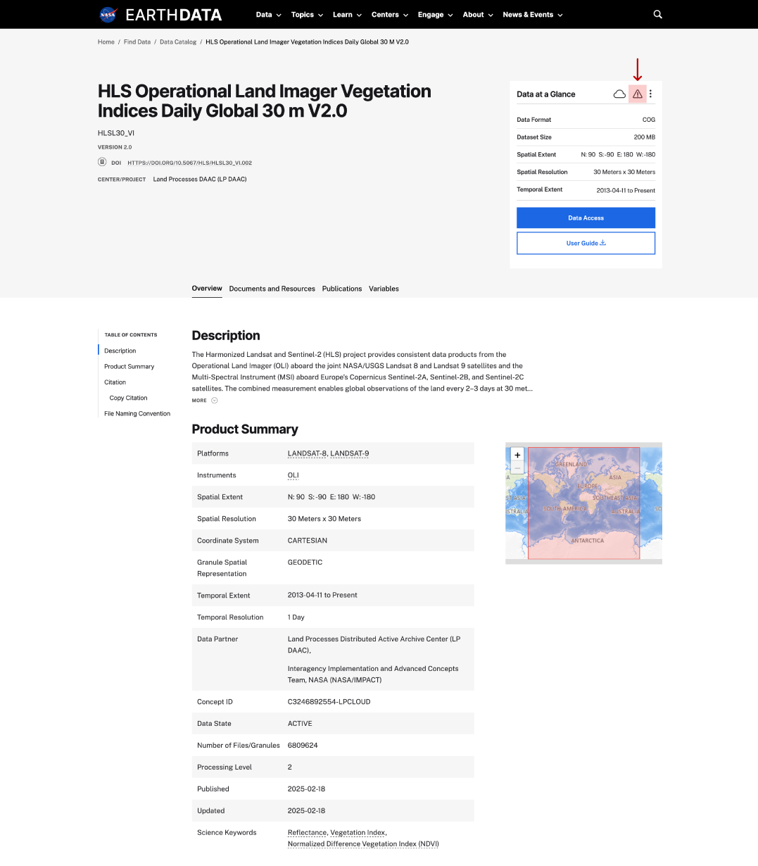
This is a screenshot of a dataset landing page showing the location of the alert icon.
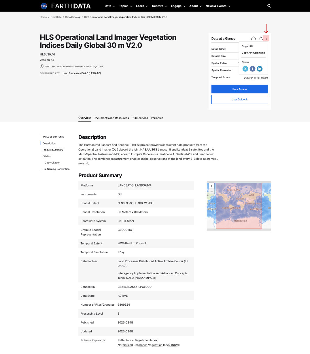
copy URL/API on dataset page
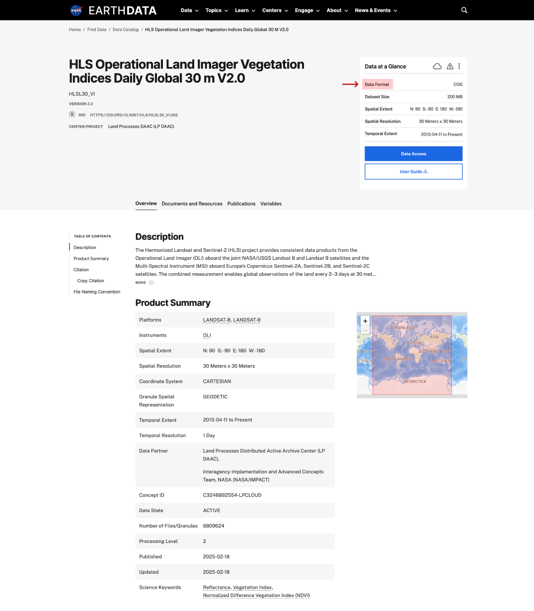
data format on dataset page
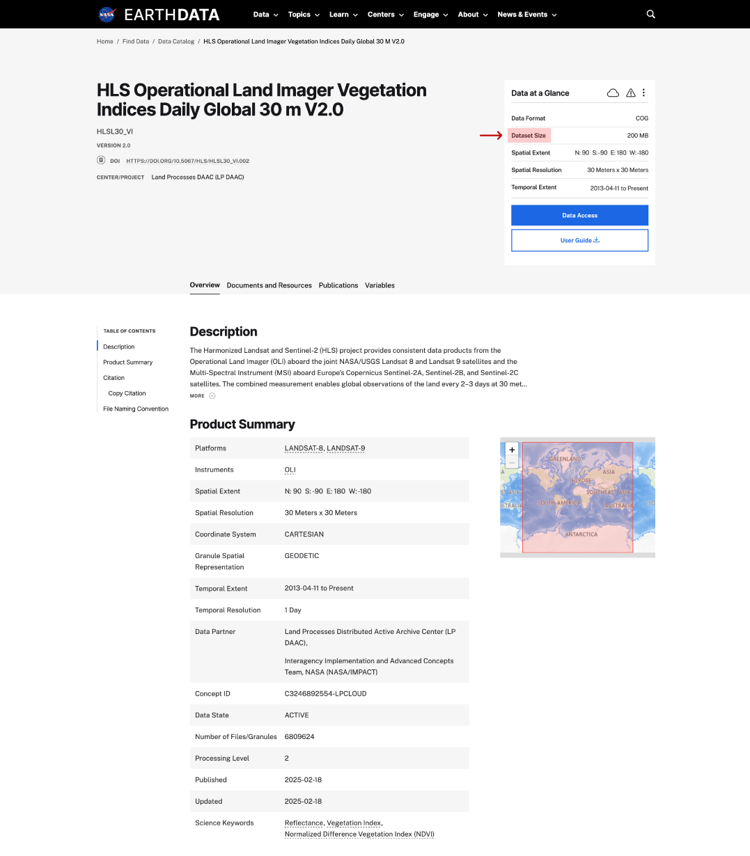
dataset size on dataset page
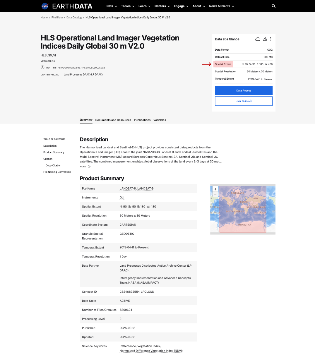
spatial extent on dataset page
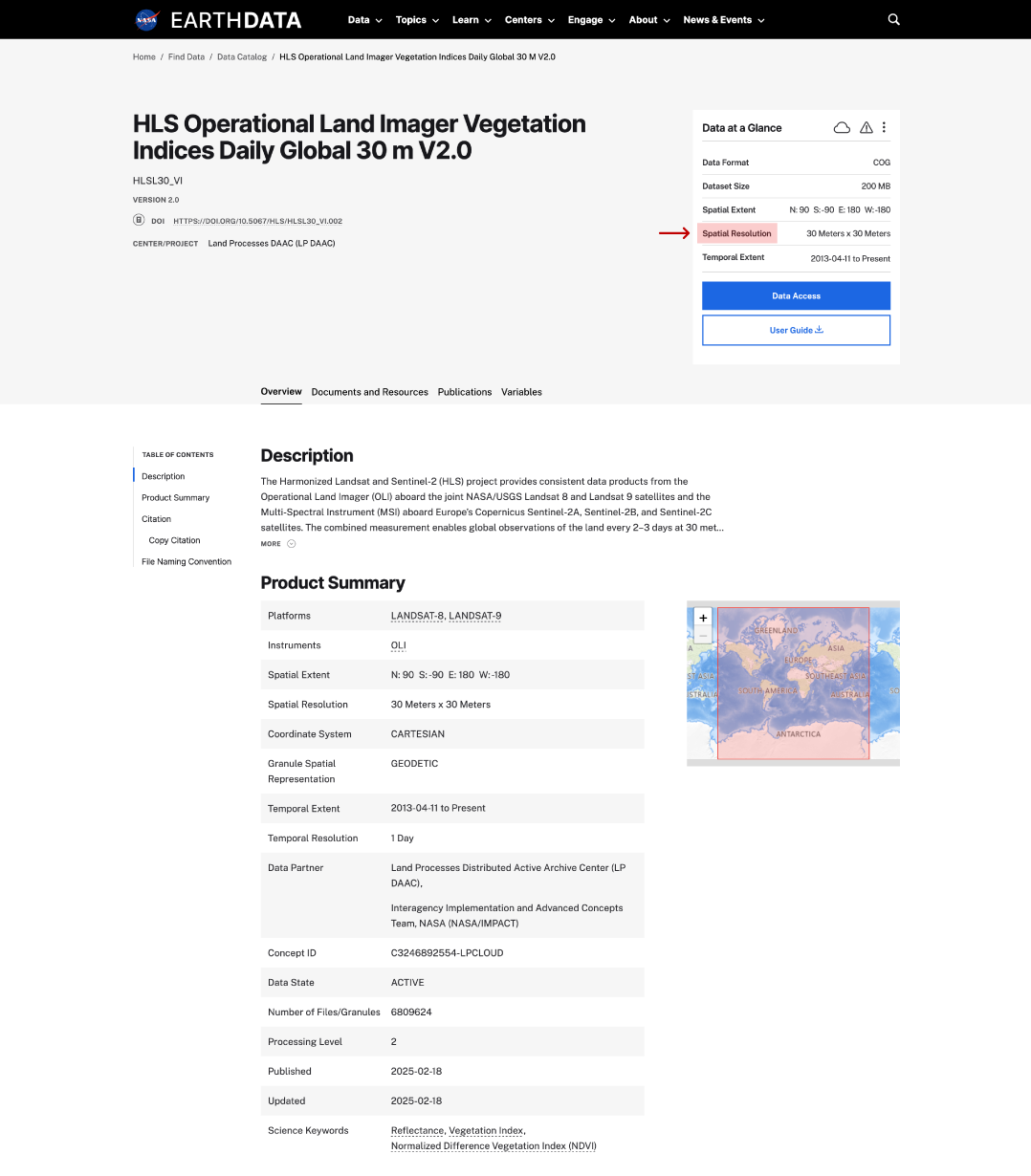
spatial resolution on dataset page
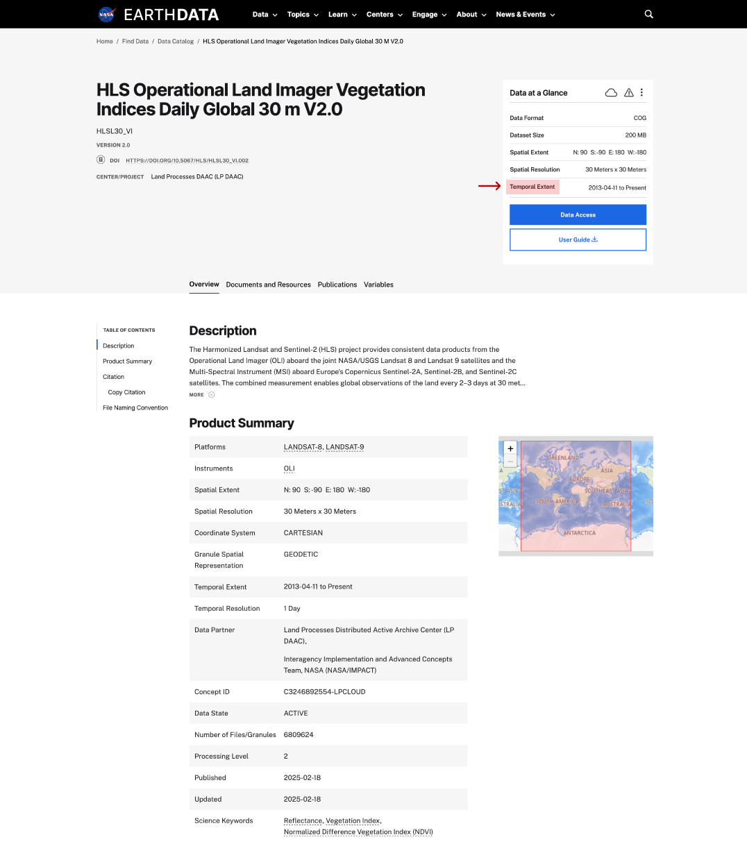
temporal extent on dataset page
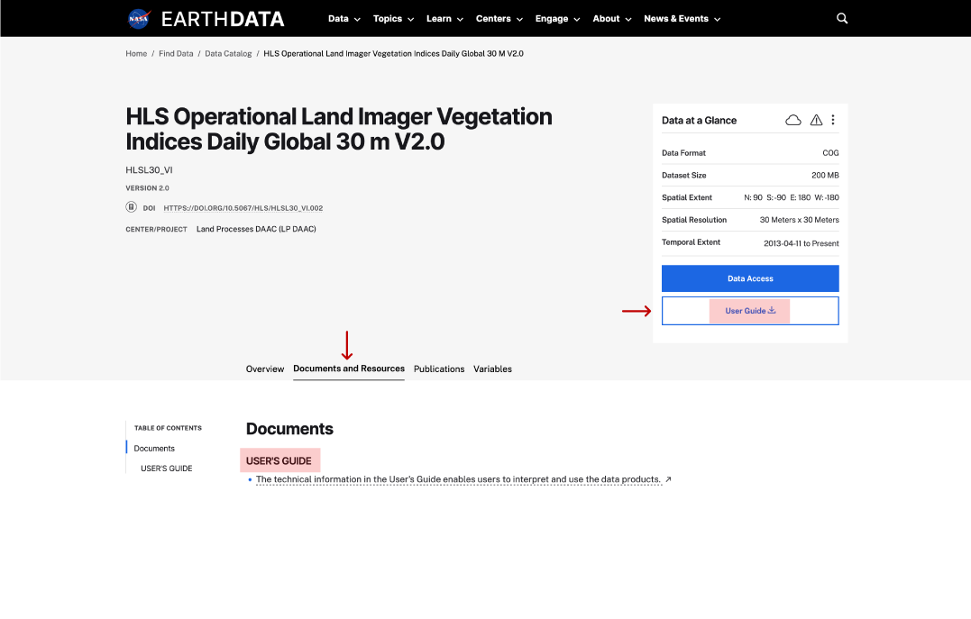
user guide on dataset page
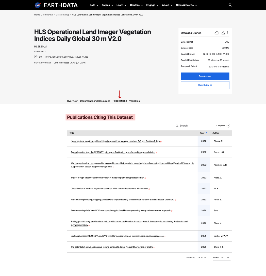
publications on dataset page
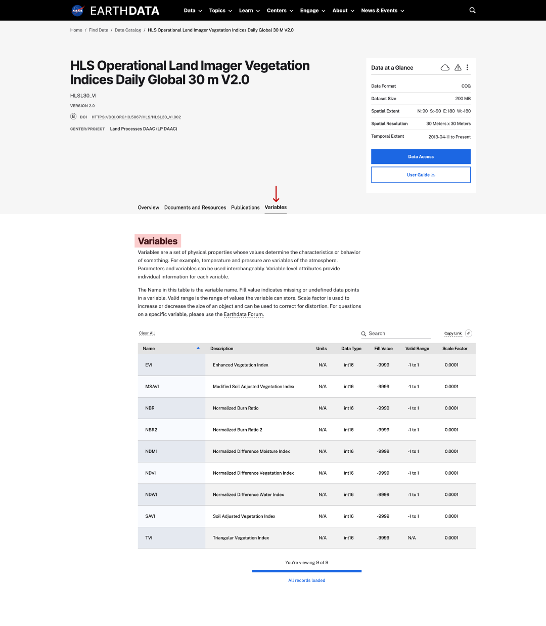
variables on dataset page
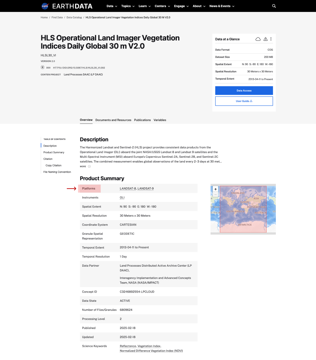
platforms on dataset page
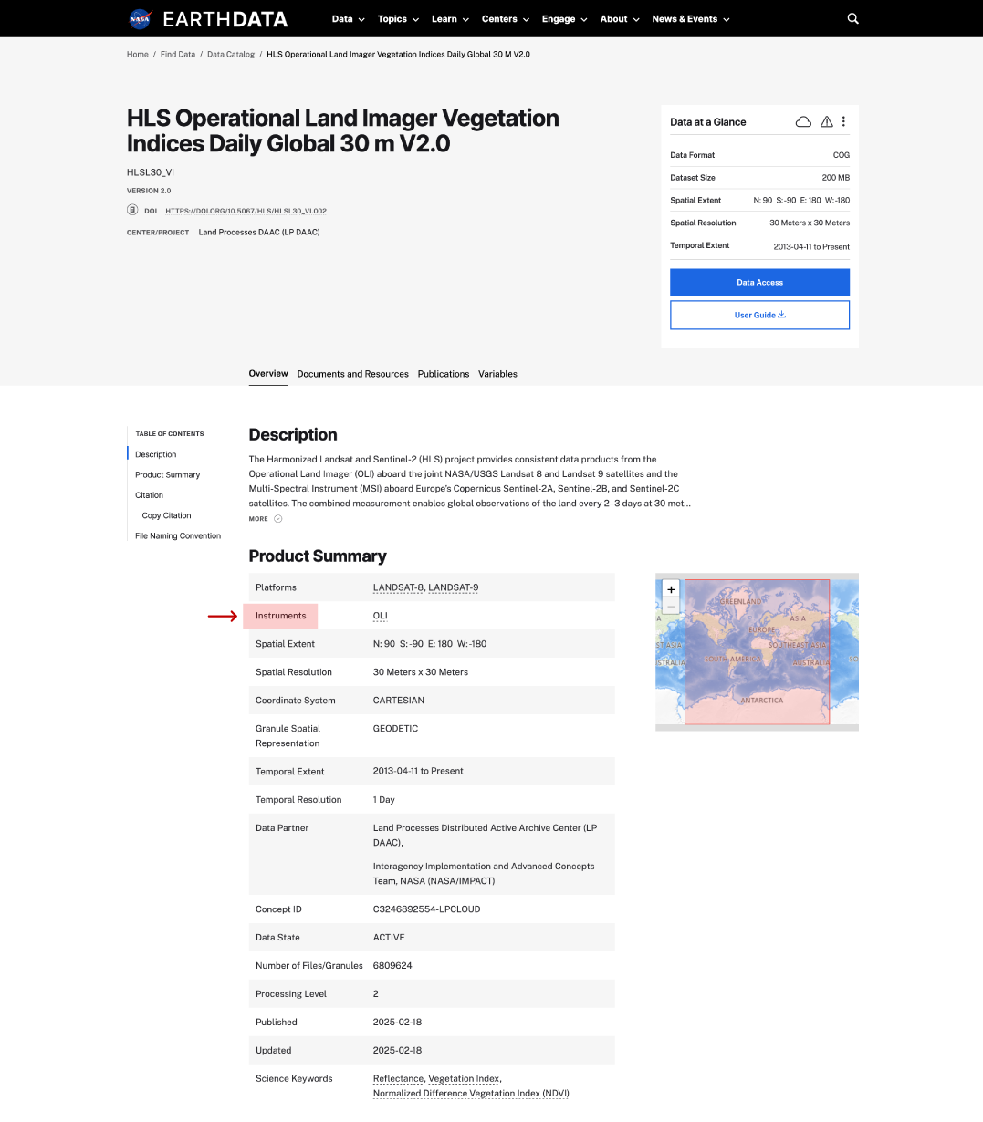
instruments on dataset page
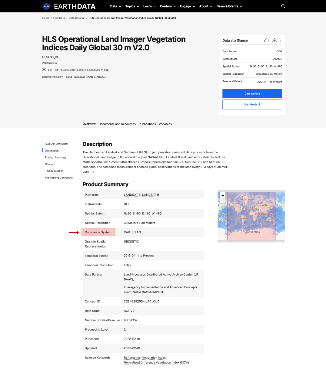
coordinate system on dataset page
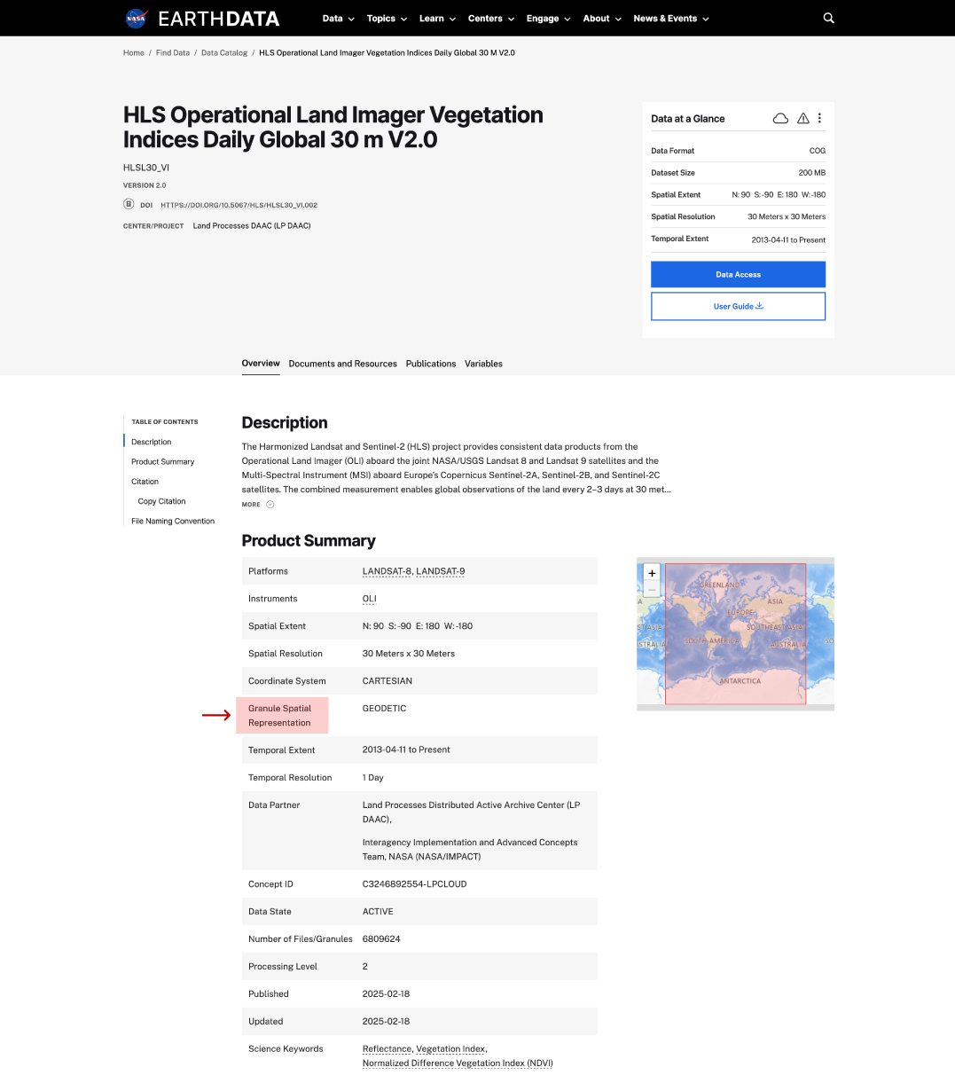
granule spatial representation on dataset page
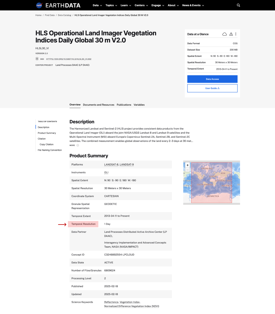
temporal resolution in dataset page
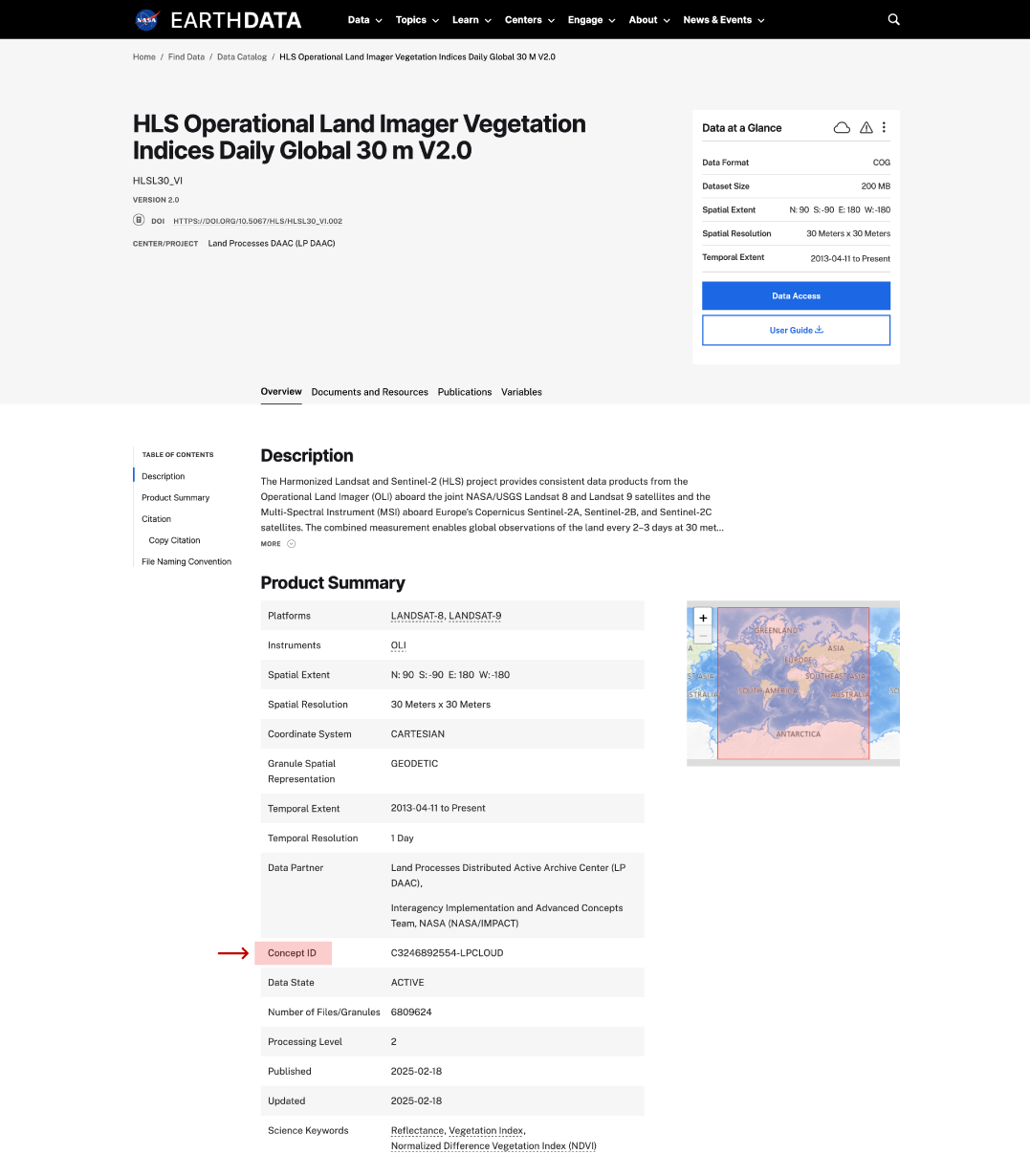
concept ID on dataset page
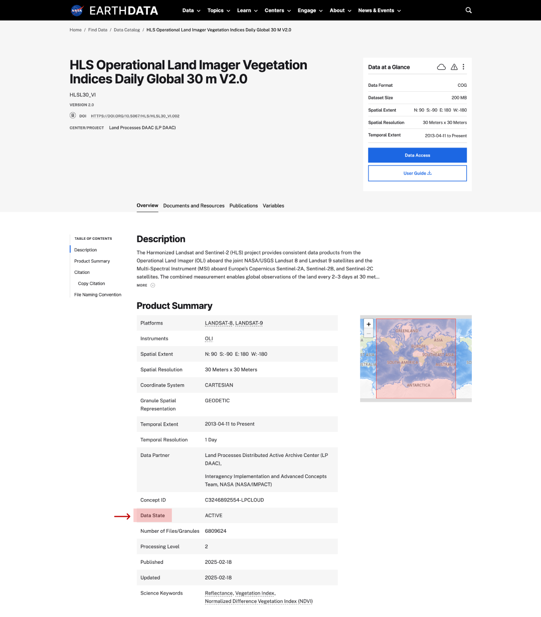
data state on dataset page
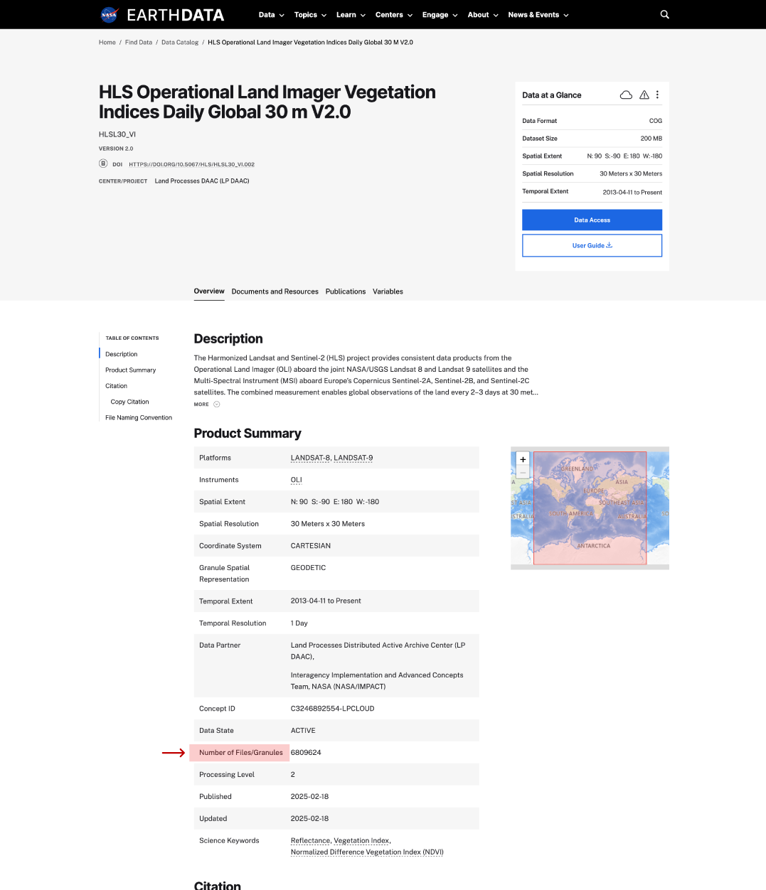
Number of files or granules
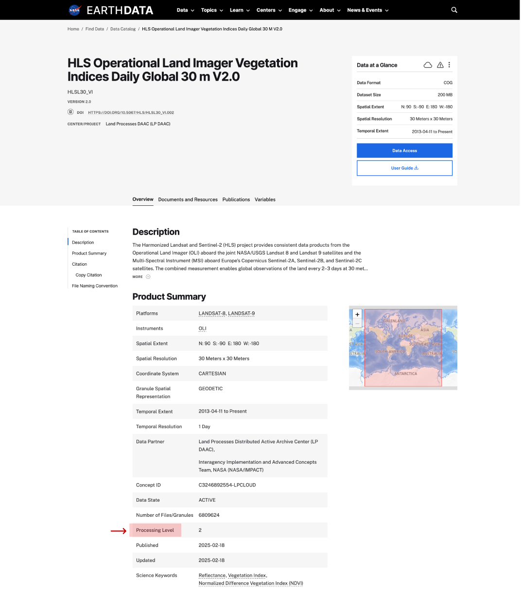
data processing level on dataset ppage
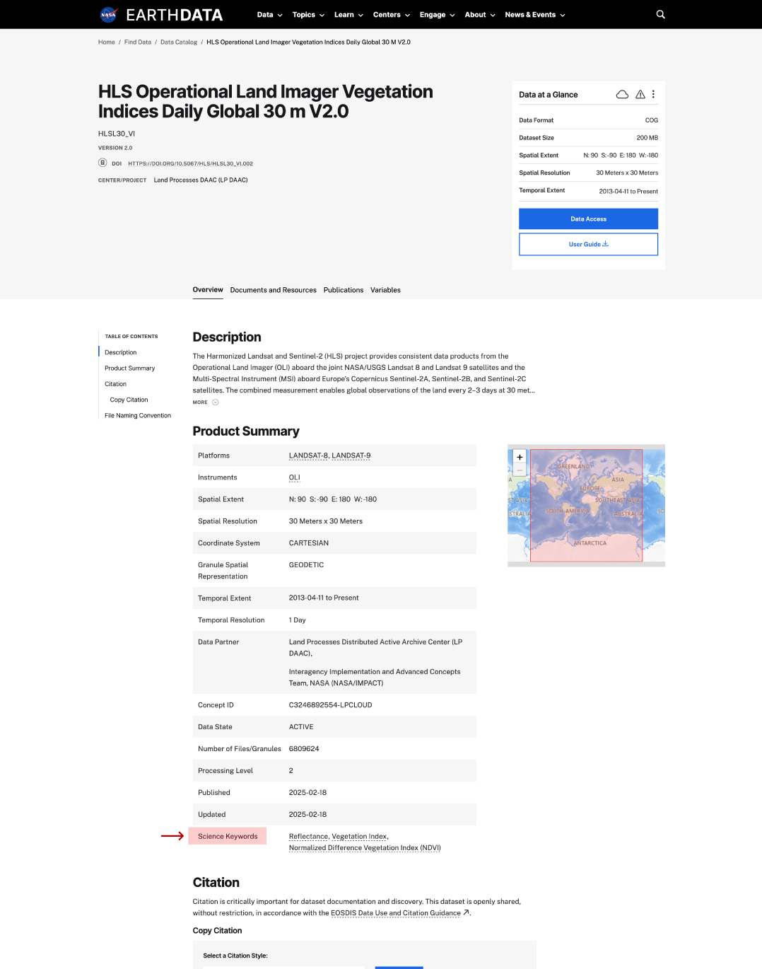
science keywords on dataset page
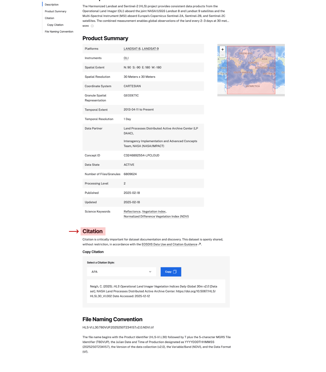
citation on dataset page
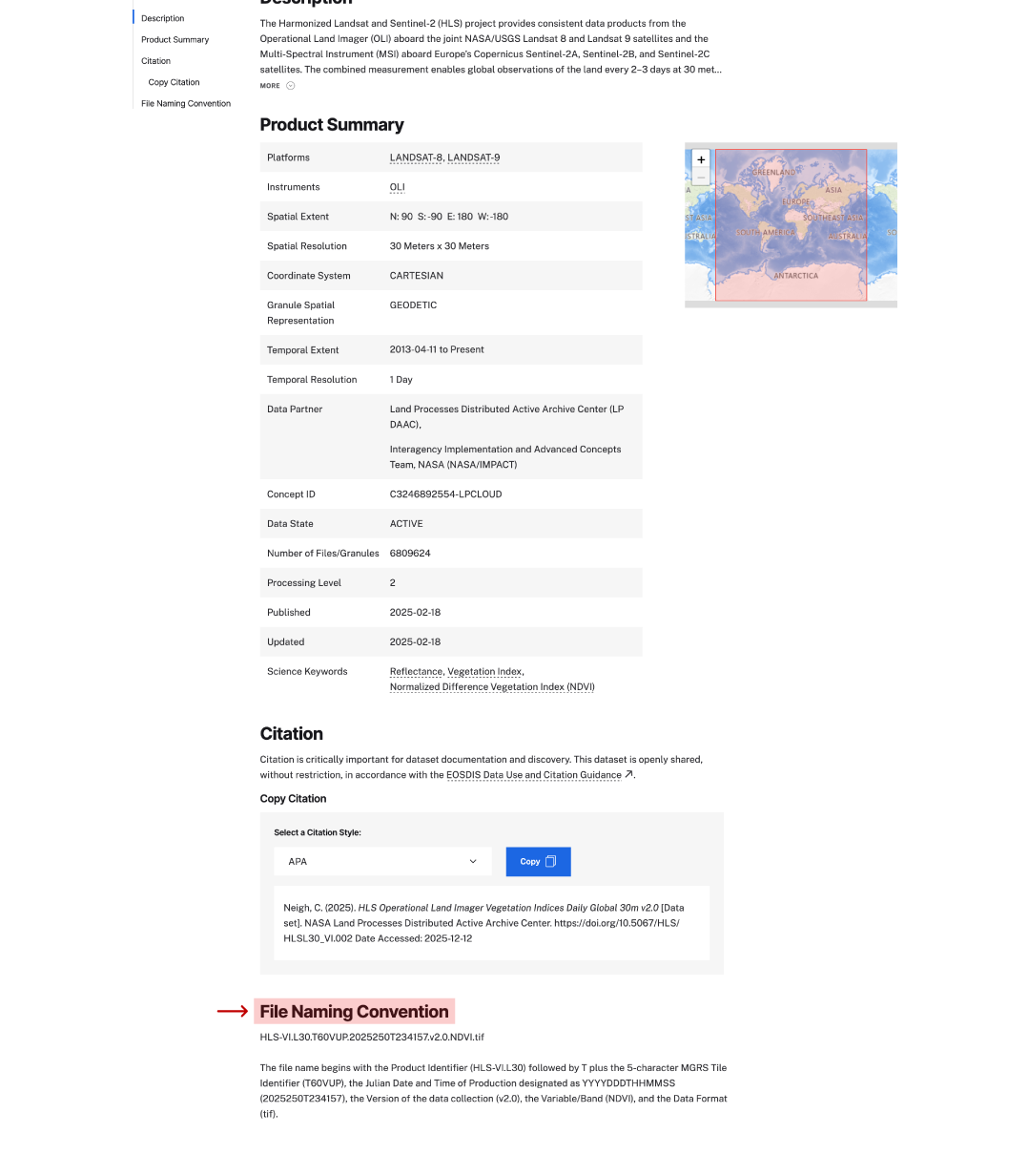
file naming convention on dataset page

Technology

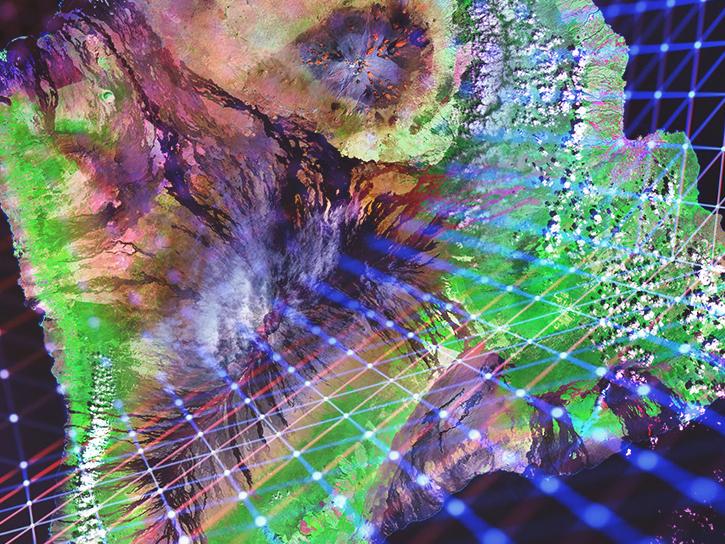
Innovations in artificial intelligence, climate models, and cloud computing are improving the ways users work with Earth science data, especially massive datasets like those expected from NISAR. NASA leverages modern computing approaches to optimize the quality of data collected and the speed at which users are able to drill down to the details they need to support on-the-ground science.

Image

Cloud Computing

Nearly all of NASA’s Earth science data is accessible through Earthdata Cloud, making access, analysis, and visualization more efficient and cost effective. We offer resources including Python libraries, tutorials, and data recipes to help users optimize working with data in the cloud.

Image

Earth Observation Data and Artificial Intelligence

The application of artificial intelligence (AI) to Earth science data makes it possible to search through large amounts of data to find relationships.

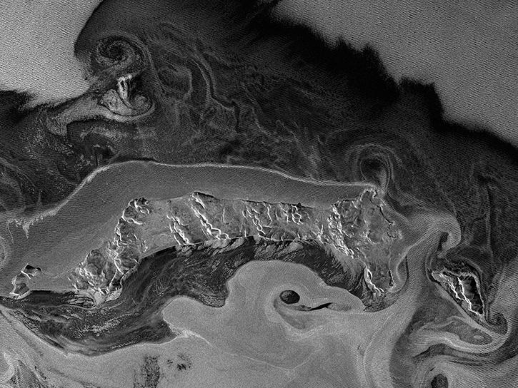
Synthetic Aperture Radar

Glossary of Terms

Reference the Earth Observation Data Basics Glossary to better understand terms related to the data provided by our program.
All
A B C D E F G H I J K L M N O P Q R S T U V W X Y Z
Science Data Management Plan (SDMP)

The SDMP describes how the program will manage the scientific data generated and captured by operational mission. The SDMP also includes descriptions of how data will be generated, processed, distributed, analyzed, and archived.

Science Data Product Software (SDPS)

Science data product generation software and software documentation. Source code used to generate products at all levels in the science data processing system.

Science Data Product Validation

Datasets and documentation. Accuracy of products, as measured by validation testing, and compared to accuracy requirements. Description of validation process, including identification of validation data sets, measurement protocols, data collection, analysis and accuracy reporting.

Science Data Products Algorithm Inputs

Identify all ancillary data or other data sets used in generation or calibration of the data or derived product at all levels

Science Data Software Tools

Product access (reader) tools. Software source code that would facilitate use of the calibration data, ancillary data and the data products at all levels.

Science Investigator-led Processing System (SIPS)

Most of the EOS standard products are produced at facilities under the direct control of the instrument Principal Investigators/Team Leaders (PIs/TLs) or their designees. These facilities are referred to as Science Investigator-led Processing Systems (SIPS). SIPS are geographically distributed across the United States and are generally, but not necessarily, collocated with the PIs/TLs’ Scientific Computing Facilities. 

Products produced at the SIPS using investigator-provided systems and software are sent to appropriate DAACs for archival and distribution. Level 0 Data Products and Ancillary Data that begin the processing sequence are stored at the DAACs and retrieved by the SIPS.

Search and Discovery

The procedure to search an archive based on specific search criteria (search) and to obtain information on available products (discovery). Data search and discovery are made possible by searchable metadata and browse image catalogues, as well as a catalogue service for making the catalogue accessible. 

During discovery, following a data search, the user finds data based on search criteria and evaluates if the data found are suitable for their application ('fit for purpose'). The user may then decide to retrieve the data.

Self-Describing File

A file that contains metadata thoroughly describing the characteristics and content of the file.

Sensor

Device which transmits an output signal as voltage in response to a physical input stimulus. In Earth observation a distinction between passives sensors, such as radiometers, and active sensors, such as radars, is common. Earth observation sensors – or instruments – are operated from different ground-/water-based, airborne, or spaceborne platforms.

Series/Collection

A grouping of science data that all come from the same source, such as a modeling group or institution. Series/collections have information that is common across all the datasets/granules they contain.

Series/Collection metadata

Metadata elements that describe an entire set of data files. Values of series/collection metadata apply to all of the files in a specific aggregate. Series/collection metadata may represent the same release of any given file, sets of data generated during an experiment, a campaign or an algorithm test.

Solar Constant

The intensity of solar radiation falling upon a unit area of surface, held at right angles to the Sun's rays at a point outside the Earth's atmosphere.

Solar Irradiance

The amount of electromagnetic radiation per unit area received at the top of the atmosphere on a plane normal to the incident radiation, and at the mean distance of the Earth from the Sun. Solar irradiance is also referred to as the solar constant. 

In satellite remote sensing, the solar irradiance is used as an onboard calibration of visible band sensors. Some climate studies suggest that small variations in the solar irradiance associated with solar activity over days to decades may have an effect the Earth's climate.

Solar Vector

The direction of incoming solar radiation. Used in conjunction with the position of a spectrometer's diffuser plate to calculate albedo.

Solar Zenith Angle

Angle between the position of the Sun and the zenith, which is the point directly over an observed target.

Spatial Coverage

An area on the surface of the Earth or an altitude range covered by a data set.

Spatial Reference

Method by which location or coverage is designated (e.g., latitude and longitude).

SpatioTemporal Asset Catalog (STAC)

STAC is a standard format definition of metatdata that describe archived datasets. STAC allows spatiotemporal assets to be easily searched/discovered and accessed. 

Spatiotemporal assets are any files that represent information about Earth for a certain space and time. STAC standards are used when cataloging metadata in the Common Metadata Repository. There are STAC standards for both on-premises and cloud datasets.

Spectrometer

Instrument used to separate and measure the distribution of energy within a spectrum of wavelengths.

Standard Product

Standard products are agency-certified key products resulting from missions or projects. They are typically acquired systematically and generated by spatially and temporally extensive systematic processing.

Standing Review Board (SRB)

The SRB is responsible for conducting independent reviews (life cycle and special) of a program/project and providing objective, expert judgments to the convening authorities. The reviews are conducted in accordance with approved Terms of Reference (ToR) and life-cycle requirements per this document and NPR 7123.1.

Stewardship

The responsibility for planning, management and certification of digital EO data sets throughout the mission phases and to ensure adequate funding. It includes curation and preservation activities. 

Data stewardship covers governance, planning, implementation and management of the sourcing, use and maintenance of space data assets. Data stewardship enables the governance of all the types and forms of space data package and the related repositories or archives.

Stratopause

Transition layer between the stratosphere and mesosphere. In the stratosphere temperature tends to increase with altitude. The stratopause marks the maximum altitudinal temperature increase within the stratosphere.

Stratosphere

The zone of the atmosphere above the troposphere that is characterized at first by isothermal conditions and then a gradual temperature increase.

Structured Vocabulary

An organized set of terms, headings or codes representing concepts and their inter-relationships, which can be used to support information retrieval.

Definition from ISO 25964-1:2011

Subsetting

The extraction of a multi-dimensional rectangular array of pixels from a single data granule, where consecutive pixels are extracted from each array dimension. For each dimension, the size of the pixel array is characterized by the starting pixel location and the number of pixels to extract.

Sulfuric Acid

Sulfuric Acid (H2SO4) is a heavy, corrosive, oily acid, and a vigorous oxidizing agent. Ozone concentrations may be affected by reactions on the surface of sulfuric acid clouds, resulting from major volcanic eruptions.

Surface Pressure

The atmospheric pressure at a location on Earth's surface exerted by the atmosphere as a consequence of gravitational attraction on the column of air lying directly above a given area. Atmospheric pressure is proportional to the weight per unit area of the atmospheric mass above that location.

Swath

A swath is defined as the area covered by the spatial samples collected during a scan of a spaceborne instrument defined by an incidence angle.

System Acceptance Review (SAR)

SARs evaluate whether a specific end item is sufficiently mature to be shipped from the supplier to its designated operational facility or launch site.

System Definition Review (SDR)

SDRs evaluate the credibility and responsiveness of the proposed program requirements/architecture to the Mission Directorate requirements and constraints, including available resources, and allocation of requirements to projects. SDRs also determine whether the maturity of the program's mission/system definition and associated plans are sufficient to begin preliminary design.

System Integration Review (SIR)

SIRs evaluate the readiness of the program, including its projects and supporting infrastructure, to begin system algorithm integration and test (AI&T) with acceptable risk and within cost and schedule constraints.

System Requirements Review (SRR)

SRRs evaluate whether the functional and performance requirements defined for the system are responsive to the Mission Directorate requirements on the program and its projects and represent achievable capabilities.

Temporal Extent or Temporal Coverage

The period during which data was collected, observations were made, or for which a model was run.

Thermopause

Transition layer between the thermosphere and exosphere, located at approximately 600km in altitude.

Thermosphere

Region of the atmosphere in which temperature increases with altitude. Located at approximately 100 to 400 km.

Token authentication

Token authentication is the method for a cloud user to acquire Simple Storage Service (S3) credentials in the cloud-based data storage system used by Amazon Web Service (AWS). 

When logging in with an Earthdata username and password a token identifier will be assigned, which can then be used to provide access to NASA Earth observation data. The tokens allow for one hour of S3 bucket access, and can be easily regenerated after each hour expires.

Total Column Ozone

Amount of ozone, measured from Earth's surface to the top of the atmosphere, over a given surface area.  Measured primarily in Dobson Units.

Trichlorofluorocarbon

Trichlorofluorocarbon (CFCl3), also known as trichloromonofluoromethane or trichlorofluoromethane, is a halocarbon compound. It is one of two primary chlorofluorocarbons that photolyze at high altitudes to release chlorine atoms and is considered an important factor in ozone depletion.

Tropopause

The tropopause is the atmospheric boundary between the troposphere and stratosphere. The tropopause is the lowest altitude (about 16-18 km near the equator and 6-10 km near the poles) at which the rate of decrease of temperature with height (called the lapse rate, which has a value of ~6.5 K/km in the troposphere) decreases to 2 K/km. 

The jet stream and atmospheric fronts introduce complex tropopause structures, e.g. a "tropopause funnel" (a bowl-shaped lowering of the tropopause). The dynamic behavior of the tropopause plays an important role in the vertical transport of trace gases.

Troposphere

The lowermost layer of the atmosphere marked by considerable turbulence and generally a decrease in temperature with increasing height.

Ultraviolet Radiation (UV)

Short wavelength region of the solar spectrum, from approximately 100 to 400 nanometers. Not part of the visible spectrum.

Uncertainty

Non-negative parameter characterizing the dispersion of the quantity values that are being attributed to a measure based on the information used. 

Where possible, this should be derived from an experimental evaluation but can also be an estimate based on other information, e.g. experience.

Unified Metadata Model (UMM) Profile

One of seven UMM metadata profiles: Collection (UMM-C), Granule (UMM-G), Service (UMM-S), Variable (UMM-Var), Visualization (UMM-Vis), Tools (UMM-T), and Common (UMM-Common).

User

External person, institution or system that consumes user services provided by the payload data ground segment via data access or a science and service exploitation platform.

User Support

User support is a function inside the payload data ground segment to support external users to interact with the segment, to handle user registration, inquiries, complaints. This function is usually provided by a help desk.

Validation

The process of assessing, by independent means, the quality of the data products derived from the system outputs.

Validation Stage

See: Data Maturity Levels

Variable

See: Parameter

Version/Release Number (also Collection)

Collection means the same thing as version; however, the MODIS science team uses the term Collection such as in MODIS Collection 5, but NSIDC uses Version as in MODIS Version 5. Also, Geoscience Laser Altimeter System (GLAS) refers to a release such as Release 33, which is also the same as version or collection. Thus, all three terms mean the same thing depending on which product you are using.

Join Our Community of NASA Data Users

While NASA data are openly available without restriction, an Earthdata Login is required to download data and to use some tools with full functionality.

Learn About the Benefits of Earthdata Login

Frequently Asked Questions

Earthdata Forum

Our online forum provides a space for users to browse thousands of FAQs about research needs, data, and data applications. You can also submit new questions for our experts to answer.

Submit Questions to Earthdata Forumand View Expert Responses

Earthdata
Forum