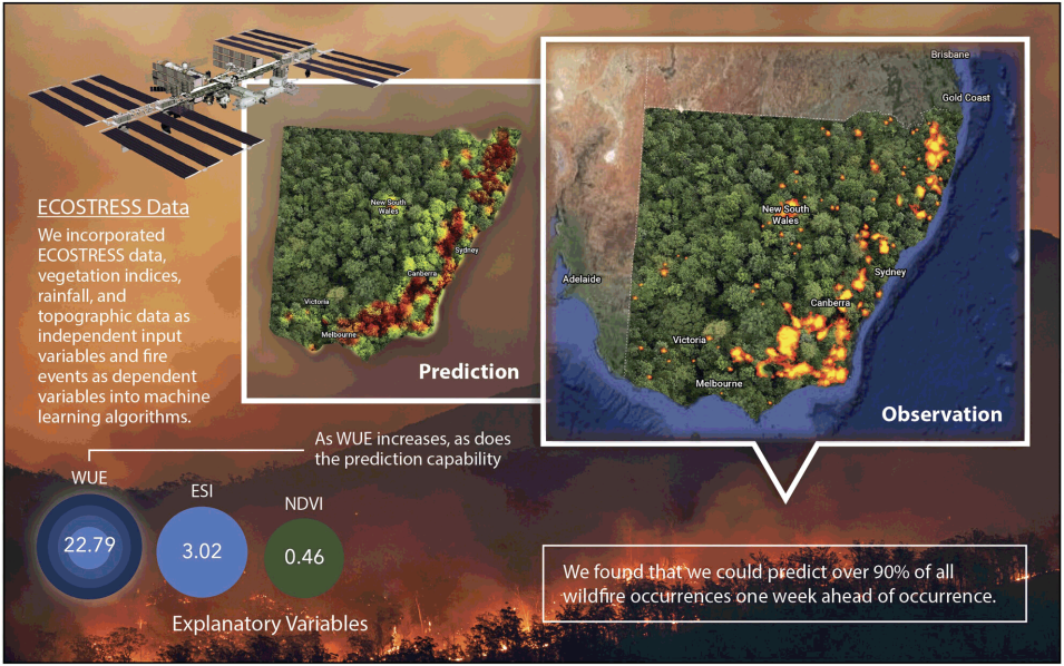
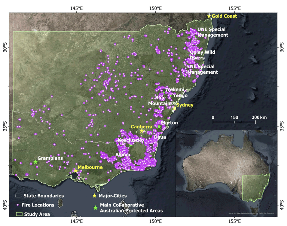
The researchers designed two types of models: “general” and “monthly.” The general models provided an overarching view of wildfire susceptibility throughout the season, while the monthly models were focused on specific time frames. The monthly models built on the insights gained from the general models to provide a finer temporal resolution for understanding and predicting wildfire risk. They then incorporated ECOSTRESS and other datasets (as independent variables) and fire event data (as dependent variables) into machine learning algorithms applied to the aforementioned 2019-2020 Australian fire season.
In general, the researcher’s machine learning approach was based on algorithms that have the capacity to “learn” from data and make accurate fire predictions based on environmental conditions. This learning process involved modeling the relationships between sets of input (i.e., independent) variables and fire occurrences (i.e., the dependent variable).
Included among those inputs were six NASA datasets, each of which is archived at NASA’s Land Processes Distributed Active Archive Center (LP DAAC). (See these under "referenced datasets" below.)
In addition, the researchers also used a GEODATA 9 second Digital Elevation Model and D8-digital elevation model version 3 and flow direction grid from Geoscience Australia and rainfall data from the Australia’s Bureau of Meteorology.
Major Findings
By combining machine learning algorithms with data on a variety of biophysical factors, the researchers’ general and monthly models were able to predict wildfire occurrence in different application scenarios. The general models provided overall insight into the critical biophysical factors contributing to wildfire occurrence, making them valuable tools for pinpointing areas that merit intensive monitoring. The monthly models were able to predict the likelihood of wildfire spreading in the near future (i.e., one week ahead) and identify the key pre-fire factors during that period. Such information can help firefighters and forest managers plan and implement firefighting measures before a fire occurs.
In addition, the researchers highlighted the significance of using ECOSTRESS data to assess the impact of water availability on key climate biomes worldwide. Both models consistently identified ECOSTRESS Water Use Efficiency (WUE) as the most influential pre-fire factor. WUE, the ratio of carbon uptake to water use, averages 1.88 grams of carbon per kilogram of water (g C kg−1 H2O) over the study area during the fire season. As the researchers demonstrate, areas with WUE exceeding 2 g C kg−1 H₂O have a 95% probability of experiencing vegetation burning during wildfire events.
ECOSTRESS Evaporative Stress Index (ESI) was also identified as a significant contributor to wildfire predictions as it captures early signs of “flash drought,” which occurs during extended periods of hot, dry, and windy conditions, leading to rapid depletion of moisture in vegetation. Taken together, these results underscore the value of ECOSTRESS data in current and future wildfire prediction analyses and point to a method of developing effective strategies for predicting, managing, and mitigating wildfires.
Reference
Zhu, Y., Murugesan, S.B., Masara, I.K., Myint, S.W. and Fisher, J.B. (2025), Examining wildfire dynamics using ECOSTRESS data with machine learning approaches: the case of South-Eastern Australia's black summer. Remote Sensing and Ecological Conservation, 11: 266-281. doi:10.1002/rse2.422

