We are in the process of migrating all NASA Earth science data sites into Earthdata from now until end of 2026. Not all NASA Earth science data and resources will appear here until then. Thank you for your patience as we make this transition.
Read about the Web Unification Project
VIIRS Resources
Earthdata resources for users working with NASA’s Visible Infrared Imaging Radiometer Suite (VIIRS) data include tutorials and other learning resources, news announcements such as instrument updates and data releases, user guides and related documents, and frequently asked questions.
VIIRS Learning Resources

Looking to learn more about Suomi NPP VIIRS global land data products available from NASA? Join us for an overview of the data products and live demos on how to access and work with the data using a variety of tools from the Land Processes DAAC.
Webinar
April 20, 2022

Join us to learn how to discover, subset, access and visualize both MODIS and VIIRS data products using a suite of user-friendly tools developed by NASA's ORNL DAAC.
Webinar
April 19, 2022

Through NASA FIRMS, users can interactively view fire data via the Fire Map, search for both VIIRS and MODIS active fires/hotspots and sign-up to receive automated Fire Email Alerts for their geographic areas of interest. Join us to learn more!
Webinar
April 19, 2022

Want to learn how to use R and Python to work with remote sensing data? Join us as we demonstrate how to perform basic data preparation, processing, computation, and visualization techniques using ASTER and VIIRS Surface Reflectance data.
Webinar
April 18, 2022

Learn how SeaBASS can be leveraged for data search, discovery, and access, and will demonstrate how SeaBASS supports NASA’s ocean color satellite products and the broader scientific community.
Webinar
April 18, 2022

Esta capacitación de ARSET cubre el Kit de herramientas de observación de la Tierra para ciudades y asentamientos humanos sostenibles.
Training
Jan. 27 - Feb. 10, 2022
This ARSET training provides an overview of the Earth Observations Toolkit for Sustainable Cities and Human Settlements.
Training
Jan. 27 - Feb. 10, 2022

This ARSET training reviews pre-fire risk assessment and post-fire mapping using open-source tools like Google Earth Engine.
Training
Jan. 18-20, 2022
SHOWING 8 OF 73
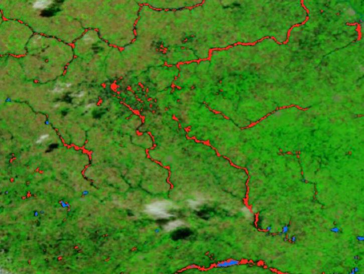
The new VIIRS near real-time product is already in use, and users are encouraged to explore this replacement option for MODIS-based flood products.
Blog
June 2, 2025
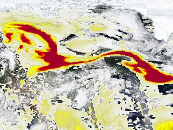
Image captured May 29, 2025, by the VIIRS and OMPS instruments aboard the joint NASA/NOAA Suomi NPP platform.
Worldview Image of the Week
May 30, 2025
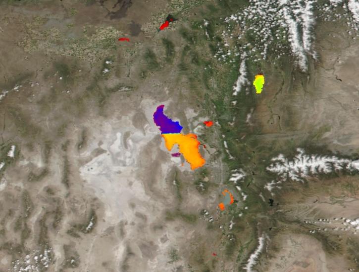
Image captured May 21, 2025, by the VIIRS instrument aboard the joint NASA/NOAA Suomi NPP platform.
Worldview Image of the Week
May 22, 2025
A summary of datasets, products, and resources released by NASA’s Distributed Active Archive Centers (DAACs) in April 2025.
News
May 13, 2025
SHOWING 4 OF 387
Frequently Asked Questions
Earthdata Forum
Our online forum provides a space for users to browse thousands of FAQs about research needs, data, and data applications. You can also submit new questions for our experts to answer.
Submit Questions to Earthdata Forumand View Expert Responses