We are in the process of migrating all NASA Earth science data sites into Earthdata from now until end of 2026. Not all NASA Earth science data and resources will appear here until then. Thank you for your patience as we make this transition.
Read about the Web Unification Project
OMI Resources
Earthdata resources for users working with NASA’s Ozone Monitoring Instrument (OMI) include tutorials and other learning resources, news announcements such as instrument updates and data releases, user guides and related documents, and frequently asked questions.
OMI Learning Resources

This ARSET training covers how to access and analyze TROPOMI data as well as its applications.
Training
May 28 - June 3, 2019

This ARSET training teaches how to use Python scripts to map and analyze air quality data through hands-on exercises.
Training
Jan. 17-22, 2018

This ARSET training provides an overview of the remote sensing process, data products, and their use in air quality applications.
Training
July 6 - Aug. 3, 2016
SHOWING 3 OF 11

Who Uses NASA Earth Science Data? Jun Wang, to study atmospheric composition and climate change; remote sensing of aerosols, clouds, and trace gases and the effects of these on global weather and climate.
Data User Story
April 22, 2021

Who Uses NASA Earth Science Data? Dr. Greg Jenkins, to study weather, climate, atmospheric chemistry, and air quality of West Africa.
Data User Story
April 19, 2021
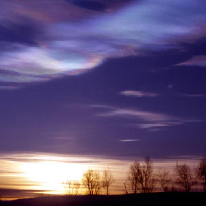
In winter 2011, an ozone hole appeared over the Arctic for the first time.
Feature Article
March 1, 2021

The webinar introduces satellite remote sensing, radiance conversion, image classification, and geophysical product creation, and more.
Webinar
Jan. 29, 2021
SHOWING 4 OF 32
Frequently Asked Questions
Earthdata Forum
Our online forum provides a space for users to browse thousands of FAQs about research needs, data, and data applications. You can also submit new questions for our experts to answer.
Submit Questions to Earthdata Forumand View Expert Responses