We are in the process of migrating all NASA Earth science data sites into Earthdata from now until end of 2026. Not all NASA Earth science data and resources will appear here until then. Thank you for your patience as we make this transition.
Read about the Web Unification Project
OLI Resources
Earthdata resources for users working with NASA’s Operational Land Imager (OLI) include tutorials and other learning resources, news announcements such as instrument updates and data releases, user guides and related documents, and frequently asked questions.
OLI Learning Resources

Find, download, and subset HLS data from a command line executable.
External Resource
GitHub Repository
April 16, 2025
Find and download HLS data.
External Resource
GitHub Repository
May 1, 2024

Tutorial demonstrating how to search for, access, and process HLS data in R.
External Resource
GitHub Repository

Join us on Thursday, May 29, to learn about the NASA JPL OPERA Surface Displacement (OPERA-DISP) dataset and how to access and explore the data using ASF DAAC's Displacement Portal.
Webinar
May 14, 2025

Use NASA's Application for Extracting and Exploring Analysis Ready Samples (AppEEARS) tool to access data for an area of interest.
Tutorial
March 13, 2025
Access data for a point of interest using NASA's Application for Extracting and Exploring Analysis Ready Samples (AppEEARS) tool.
Tutorial
March 13, 2025

Worldview has added an “Available Imagery Dates” selector to help users find Harmonized Landsat and Sentinel-2 (HLS) imagery for their area of interest.
Tutorial
Feb. 25, 2025
Satellite Needs Working Group (SNWG) solutions, such as Harmonized Landsat and Sentinel-2 (HLS), assist agencies with their existing workflows and decision-making processes by creating actionable science.
Data in Action
Oct. 3, 2024
SHOWING 8 OF 82

IMPACT was instrumental to a recent enhancement of NASA’s Fire Information for Resource Management System.
Blog
June 8, 2022

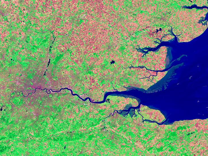
Image captured on Mar 24, 2022 by the OLI instrument aboard the Landsat 8 satellite.
Worldview Image of the Week
May 19, 2022

This Earth Day we invite you to explore global, full-resolution NASA Earth science imagery to see volcanoes erupting, wildfires spreading, tropical cyclones forming, and city lights illuminating. With NASA Worldview, you can also take a snapshot, create an animated GIF, or compare imagery from two dates to view changes over time.
Feature Article
May 17, 2022

Data from NASA’s NSIDC DAAC helps scientists like Dr. Kristin Poinar develop the next generation of models for forecasting sea-level rise from melting glaciers and ice sheets.
Data User Story
May 3, 2022
SHOWING 4 OF 66
Frequently Asked Questions
Earthdata Forum
Our online forum provides a space for users to browse thousands of FAQs about research needs, data, and data applications. You can also submit new questions for our experts to answer.
Submit Questions to Earthdata Forumand View Expert Responses