We are in the process of migrating all NASA Earth science data sites into Earthdata from now until end of 2026. Not all NASA Earth science data and resources will appear here until then. Thank you for your patience as we make this transition.
Read about the Web Unification Project
MODIS Resources
Earthdata resources for users working with NASA’s Moderate Resolution Imaging Spectroradiometer (MODIS) data include tutorials and other learning resources, news announcements such as instrument updates and data releases, user guides and related documents, and frequently asked questions.
MODIS Learning Resources

Learn to interpret Moderate Resolution Imaging Spectroradiometer (MODIS) Surface Reflectance data quality via Quality Assurance bits, tools, and resources.
Tutorial
Jan. 23, 2017

Learn how to interpret Moderate Resolution Imaging Spectroradiometer (MODIS) Land Surface Temperature data quality information, including decoding binary quality layers and utilizing tools for data analysis.
Tutorial
Jan. 23, 2017

Learn how to access Moderate Resolution Imaging Spectroradiometer (MODIS) Surface Reflectance data through Earthdata Search.
Tutorial
Jan. 23, 2017

Learn now NASA's Soil Moisture Active Passive (SMAP) satellite and other satellite instruments were used to create a comprehensive chronology of the flood from land to ocean.
Data in Action
Dec. 6, 2016

Discover how a NASA DEVELOP team developed a tool to understand drought impact and avoid long-term effects.
Data in Action
Nov. 30, 2016

Learn how to access and use Moderate Resolution Imaging Spectroradiometer (MODIS) Version 6 land data.
Webinar
Nov. 22, 2016

This visualization shows 34 years of Earth's seasonal vegetation changes, driven by its orbit and tilt, using NASA's MEaSUREs Vegetation Index and Phenology (VIP) Version 4 collection.
Tutorial
Nov. 22, 2016

Explore the stunning autumn foliage in Eastern Asia from space with NASA remote sensing data.
Data in Action
Nov. 9, 2016
SHOWING 8 OF 221

The webinar introduces satellite remote sensing, radiance conversion, image classification, and geophysical product creation, and more.
Webinar
Jan. 29, 2021
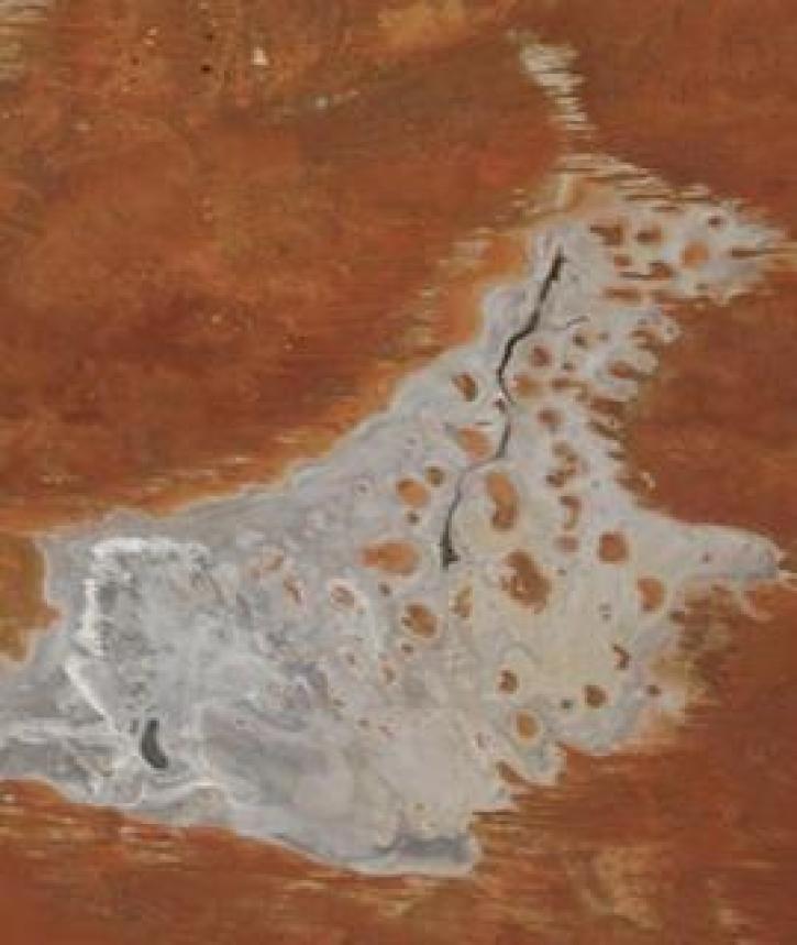
Image captured on 11 January 2021, by the MODIS instrument, aboard the Terra satellite.
Worldview Image of the Week
Jan. 19, 2021
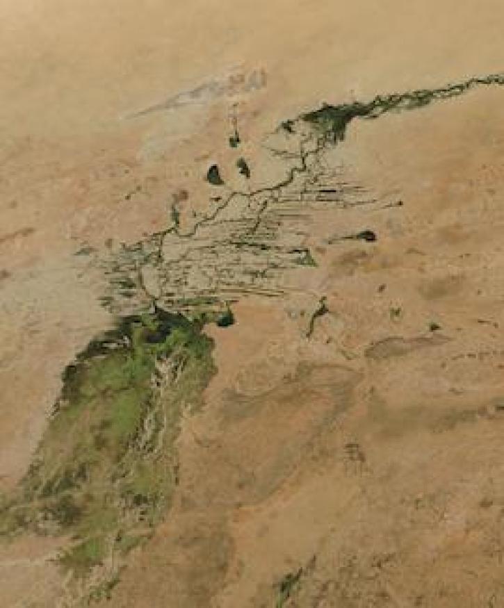
Image captured on 3 January 2021, by the MODIS instrument, aboard the Aqua satellite.
Worldview Image of the Week
Jan. 11, 2021

The Global Navigation Satellite System (GNSS) enables the precise location of points on Earth’s surface. For geodesists like Dr. Herring, it also is a key geodetic technique for his studies of surface deformation processes.
Data User Story
Jan. 7, 2021
SHOWING 4 OF 525
Frequently Asked Questions
Earthdata Forum
Our online forum provides a space for users to browse thousands of FAQs about research needs, data, and data applications. You can also submit new questions for our experts to answer.
Submit Questions to Earthdata Forumand View Expert Responses