We are in the process of migrating all NASA Earth science data sites into Earthdata from now until end of 2026. Not all NASA Earth science data and resources will appear here until then. Thank you for your patience as we make this transition.
Read about the Web Unification Project
GLAS Resources
Read the latest Geoscience Laser Altimeter System (GLAS) news and access learning resources designed to help you optimize your Earth science research.
GLAS Learning Resources
Working with data in the cloud can seem daunting, but it doesn’t need to be! Join us August 2 at 2 p.m., EDT [UTC -4], for a demonstration of two straightforward workflows for accessing NASA's snow and ice data in the Earthdata Cloud.
Webinar
July 16, 2023

Join us to learn how to harmonize IceBridge, ICESat-1, and ICESat-2 data products into similar formats and apply the necessary geophysical corrections for users to immediately access, compare, and visualize data using Python and Jupyter Notebook based tools.
Webinar
May 5, 2021
SHOWING 2 OF 2
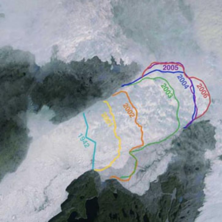
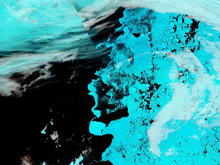
Greenland’s more than 200 major outlet glaciers are constantly on the move—many of them at some of the fastest speeds ever recorded.
Feature Article
Nov. 4, 2020

Data from NASA’s ICESat-2 mission provide incredibly accurate measurements of Earth elevation change—and much more.
Feature Article
Nov. 4, 2020
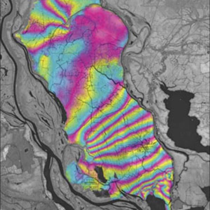
A technique to study land senses water-level changes in the Mississippi River delta.
Feature Article
July 28, 2020
SHOWING 3 OF 15
Frequently Asked Questions
Earthdata Forum
Our online forum provides a space for users to browse thousands of FAQs about research needs, data, and data applications. You can also submit new questions for our experts to answer.
Submit Questions to Earthdata Forumand View Expert Responses