We are in the process of migrating all NASA Earth science data sites into Earthdata from now until end of 2026. Not all NASA Earth science data and resources will appear here until then. Thank you for your patience as we make this transition.
Read about the Web Unification Project
Ocean News
Articles, resources, and announcements from Ocean.

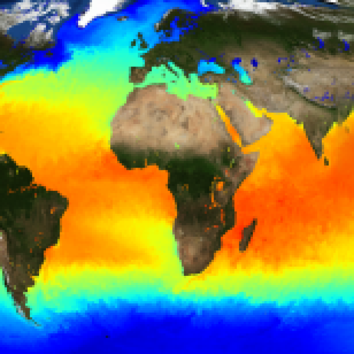
Image captured on 3 December 2020, by the MODIS instrument, aboard the Terra satellite.
Worldview Image of the Week
Dec. 21, 2020

Who uses NASA Earth science data? Ben Holt, to study polar sea ice, coastal oceanography, and marine pollution
Data User Story
Dec. 21, 2020
The public release of the NAVO GHRSST Level 4 K10-SST GDS2.0 product provides global daily analyzed SST at a 1-meter reference depth.
News
Nov. 4, 2020

The 16 datasets in the West Africa Coastal Vulnerability Mapping collection provide a wealth of information about the stresses affecting this important region.
Feature Article
Nov. 4, 2020

Data collected by the autonomous Saildrone unmanned surface vehicle (USV) during its 60-day cruise along the California coast and Baja Peninsula are now available at PO.DAAC.
Feature Article
Nov. 4, 2020
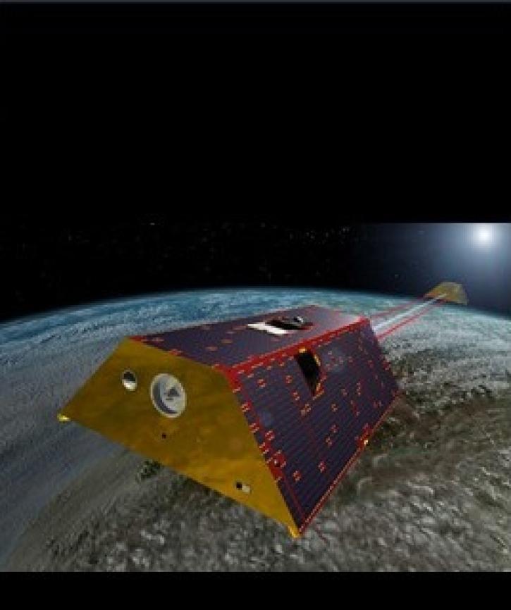
Two datasets from the Gravity Recovery and Climate Experiment Follow-On (GRACE-FO) mission have just been released by NASA’s PO.DAAC.
Feature Article
Nov. 4, 2020

Data from NASA’s ICESat-2 mission provide incredibly accurate measurements of Earth elevation change—and much more.
Feature Article
Nov. 4, 2020

Data from the Oceans Melting Greenland (OMG) mission provide a revolutionary look at ocean/ice interactions and estimates of global sea level rise.
News
Nov. 4, 2020
SHOWING 8 OF 208