Delivery of Suomi National Polar-orbiting Partnership (Suomi NPP) satellite data products will cease on November 1, 2026. Data users should transition now to alternative products from NOAA-21 and NOAA-20.
Suomi NPP data announcement
Soils Data Access and Tools
Soils Datasets
| Dataset Sort descending | Version | Platform | Instrument | Temporal Extent | Spatial Extent | Spatial Resolution | Data Format |
|---|---|---|---|---|---|---|---|
| ABoVE: Ignitions, burned area and emissions of fires in AK, YT, and NWT, 2001-2015 | 1 | COMPUTERS, Terra, Aqua | Computer, MODIS | 2001-01-01 to 2015-12-31 |
N: 75.7456 S: 59.9918 E: -99.9997 W: -176.932 |
multiple | |
| ABoVE: Ignitions, Burned Area, and Emissions of Fires in AK, YT, and NWT, 2001-2018 | 2 | Aqua, MODELS | MODIS, Computer | 2001-01-01 to 2018-12-31 |
N: 79.2618 S: 51.6346 E: -99.9838 W: -167 |
multiple | |
| ABoVE: Land Cover, Methane Flux, and Environmental Data, Big Trail Lake, Fairbanks AK | 1 | MODELS, FIELD INVESTIGATION | Computer, SOIL MOISTURE PROBE | 2017-05-28 to 2022-08-23 |
N: 64.9231 S: 64.9201 E: -147.816 W: -147.825 |
multiple | |
| ABoVE: Light-Curve Modelling of Gridded GPP Using MODIS MAIAC and Flux Tower Data | 1 | Terra, MODELS, METEOROLOGICAL STATIONS, Aqua | MODIS, Computer, MMS | 2000-01-01 to 2018-01-01 |
N: 79.7489 S: 50.0604 E: -73.6407 W: -172.078 |
HDF4 | |
| ABoVE: Monthly Hydrological Fluxes for Canada and Alaska, 1979-2018 | 1 | MODELS | Computer | 1979-01-01 to 2018-04-01 |
N: 83.125 S: 41.7508 E: -53.4255 W: -172.25 |
multiple | |
| ABoVE: Multi-model Uncertainty of Carbon Stocks and Fluxes across ABoVE Domain, 2003 | 1 | MODELS | Computer | 2003-01-01 to 2003-12-31 |
N: 81.4094 S: 39.4094 E: -67.1247 W: -176.125 |
GeoTIFF | |
| ABoVE: Permafrost Measurements and Distribution Across the Y-K Delta, Alaska, 2016 | 1 | IKONOS, FIELD SURVEYS, Airplane | Schmidt-Cassegrain Telescope, SOIL DEPTH PROBE, LIDAR | 2009-06-27 to 2016-07-17 |
N: 61.2881 S: 61.1694 E: -165.03 W: -165.69 |
multiple | |
| ABoVE: Post-Fire and Unburned Field Site Data, Anaktuvuk River Fire Area, 2008-2017 | 1 | FIELD SURVEYS | SOIL DEPTH PROBE, VISUAL OBSERVATIONS | 2008-07-03 to 2017-07-23 |
N: 69.359 S: 69.0189 E: -150.034 W: -151.176 |
CSV | |
| ABoVE: Post-Fire and Unburned Vegetation Community and Field Data, NWT, Canada, 2017 | 1 | FIELD INVESTIGATION | VISUAL OBSERVATIONS, SOIL MOISTURE PROBE | 2015-07-13 to 2017-08-10 |
N: 62.5827 S: 60.5236 E: -111.367 W: -117.379 |
multiple | |
| ABoVE: Post-Fire and Unburned Vegetation Community and Field Data, NWT, Canada, 2018 | 1 | FIELD SURVEYS | SOIL MOISTURE PROBE, STEEL MEASURING TAPE | 2018-08-12 to 2018-08-22 |
N: 62.5658 S: 60.4524 E: -113.42 W: -117.425 |
CSV | |
| ABoVE: Post-Fire and Unburned Vegetation Community and Field Data, NWT, Canada, 2019 | 1 | FIELD INVESTIGATION | SOIL MOISTURE PROBE, SOIL TEMPERATURE PROBE, SOIL DEPTH PROBE | 2018-08-16 to 2019-09-05 |
N: 62.5658 S: 60.9206 E: -113.016 W: -117.425 |
CSV | |
| ABoVE: Soil Drainage Maps from L-band SAR across Four Sites in Alaska and Canada | 1 | ALOS-2, ALOS | PALSAR-2, PALSAR | 2006-06-14 to 2023-07-31 |
N: 64.7749 S: 56.5396 E: -114.626 W: -148.369 |
COG | |
| ABoVE: Soil Moisture and Active Layer Thickness in Alaska and NWT, Canada, 2008-2020 | 1 | FIELD SURVEYS | PROBES, GPR, TDR | 2008-06-22 to 2020-08-15 |
N: 71.3236 S: 60.4524 E: -111.368 W: -165.973 |
CSV | |
| ABoVE: Soil Moisture and Active Layer Thickness in Alaska, USA and Canada, 2005-2024 | 2 | FIELD SURVEYS | SOIL MOISTURE PROBE, SOIL DEPTH PROBE | 2005-01-10 to 2024-08-25 |
N: 71.3236 S: 58.2077 E: -111.368 W: -165.974 |
CSV | |
| ABoVE: Soil Moisture and ALT Field Collection Protocols and Probe Calibration | 1 | FIELD SURVEYS | SOIL DEPTH PROBE, SOIL MOISTURE PROBE, SURVEYING TOOLS | 2015-01-01 to 2024-12-31 |
N: 81.6086 S: 39.415 E: -66.9178 W: -176.125 |
||
| ABoVE: Soil Temperature and VWC at Unburned and Burned Sites Across Alaska, 2016-2023 | 1 | FIELD SURVEYS | TEMPERATURE LOGGERS, TEMPERATURE SENSORS | 2016-08-11 to 2023-09-02 |
N: 68.9908 S: 61.2701 E: -146.558 W: -163.239 |
CSV | |
| ABoVE: Soil Temperature Profiles, USArray Seismic Stations, 2016-2021 | 1.1 | FIELD INVESTIGATION | TEMPERATURE LOGGERS, SOIL TEMPERATURE PROBE | 2016-05-13 to 2021-07-08 |
N: 71.0033 S: 59.2533 E: -141.594 W: -165.35 |
multiple | |
| ABoVE: Soil Temperature Profiles, USArray Seismic Stations, AK and Canada, 2016-2019 | 1 | FIELD SURVEYS | TEMPERATURE LOGGERS, TEMPERATURE SENSORS | 2016-06-25 to 2019-08-22 |
N: 69.9175 S: 63.8864 E: -134.343 W: -163.178 |
CSV | |
| ABoVE: Spatial Estimates of Carbon Combustion from Wildfires across SK, Canada, 2015 | 1 | MODELS | Computer | 2015-04-06 to 2015-08-11 |
N: 61.2389 S: 51.1943 E: -100.168 W: -116.055 |
GeoTIFF | |
| ABoVE: Study Domain and Standard Reference Grids | 1 | FIELD SURVEYS | Computer | 2014-01-01 to 2021-12-31 |
N: 90 S: -90 E: 180 W: -180 |
||
| ABoVE: Study Domain and Standard Reference Grids, Version 2 | 2.1 | FIELD SURVEYS | Computer | 2014-01-01 to 2023-04-20 |
N: 90 S: -90 E: 180 W: -180 |
multiple | |
| ABoVE: Synthesis of Burned and Unburned Forest Site Data, AK and Canada, 1983-2016 | 1 | MODELS, FIELD INVESTIGATION | Computer, PROBES, SOIL SAMPLER | 1983-01-01 to 2016-08-08 |
N: 67.2297 S: 53.1911 E: -88.612 W: -150.902 |
CSV | |
| ABoVE: Thaw Depth at Selected Unburned and Burned Sites Across Alaska | 1.0 | FIELD SURVEYS | PROBES | 2016-08-09 to 2018-08-28 |
N: 68.9911 S: 61.27 E: -146.558 W: -163.239 |
CSV | |
| ABoVE: TVPRM Simulated Net Ecosystem Exchange, Alaskan North Slope, 2008-2017 | 1 | METEOROLOGICAL STATIONS, OCO-2, COMPUTERS, SATELLITES | TEMPERATURE SENSORS, THERMOMETERS, OCO SPECTROMETERS, Computer, MODIS | 2008-01-01 to 2017-12-31 |
N: 77.2626 S: 56.0895 E: -128.592 W: -177.469 |
netCDF-4 classic | |
| ABoVE: Wildfire Carbon Emissions and Burned Plot Characteristics, NWT, CA, 2014-2016 | 1 | MODELS, FIELD SURVEYS, LABORATORY | Computer, STEEL MEASURING TAPE, CARBON ANALYZERS | 2014-07-02 to 2016-08-01 |
N: 71.6982 S: 56.2534 E: -102 W: -136.127 |
multiple |
Featured Soils Observation Method: MODIS
The Moderate Resolution Imaging Spectroradiometer (MODIS) aboard the Aqua and Terra platforms continually collects global data approximately every two days. One MODIS product, normalized vegetation difference index data, can be used to predict how much carbon dioxide is emitted from soils, which is major component of the global carbon cycle. Carbon is released in the process called soil respiration and driven by the decomposition of surface litter through microbial activity.
Researchers taught the SatVision Top-of-Atmosphere foundation model to recognize MODIS imagery features.
4 MIN READ

The Visible Infrared Imaging Radiometer Suite (VIIRS) will help ensure continuity of Earth observations after the upcoming retirement of the Moderate Resolution Imaging Spectroradiometer (MODIS).
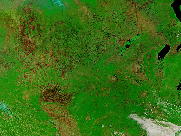
Learn how to access and use Moderate Resolution Imaging Spectroradiometer (MODIS) Version 6 land data.
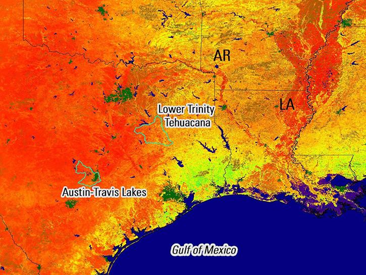
Remote sensing data's drought-indicating parameters are essential to manage the impact of water scarcities and minimize drought losses.
Soils Data Tools
| Tool Sort descending | Description | Services | |
|---|---|---|---|
| Vertex | Vertex is a graphical search interface for finding synthetic aperture radar (SAR) data. | Search and Discovery, Access, Downloading, Processing, Subsetting |
SHOWING 1 OF 1
Get Help
QUESTIONS & SUPPORT
Have a question?
Get help with NASA Earth science data, datasets, tools, services, and metadata on the Earthdata Forum. Experienced staff in the data user community review and answer questions.
Get help on Earthdata ForumEarthdata
Forum
Forum