We are in the process of migrating all NASA Earth science data sites into Earthdata from now until end of 2026. Not all NASA Earth science data and resources will appear here until then. Thank you for your patience as we make this transition.
Read about the Web Unification Project
Land Surface News
Articles, resources, and announcements from Land Surface.
NASA researchers are using high resolution airborne data to determine the vulnerability and resilience of the Mississippi River Delta.
Feature Article
April 12, 2021

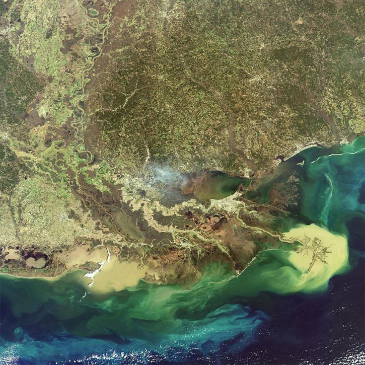
Image captured on 7 March 2021, by the VIIRS instrument, aboard the joint NASA/NOAA Suomi NPP satellite.
Worldview Image of the Week
March 15, 2021
Find EOSDIS dataset and data tool news, top stories, featured data images, webinars, links to new learning resources, data recipes, and Data User Profiles.
News
March 10, 2021

SRTMGL1 coverage now includes Africa, Europe, North America, South America, Asia, and Australia in 1° X 1° tiles at 1 arc second (about 30 meters) resolution.
News
March 1, 2021
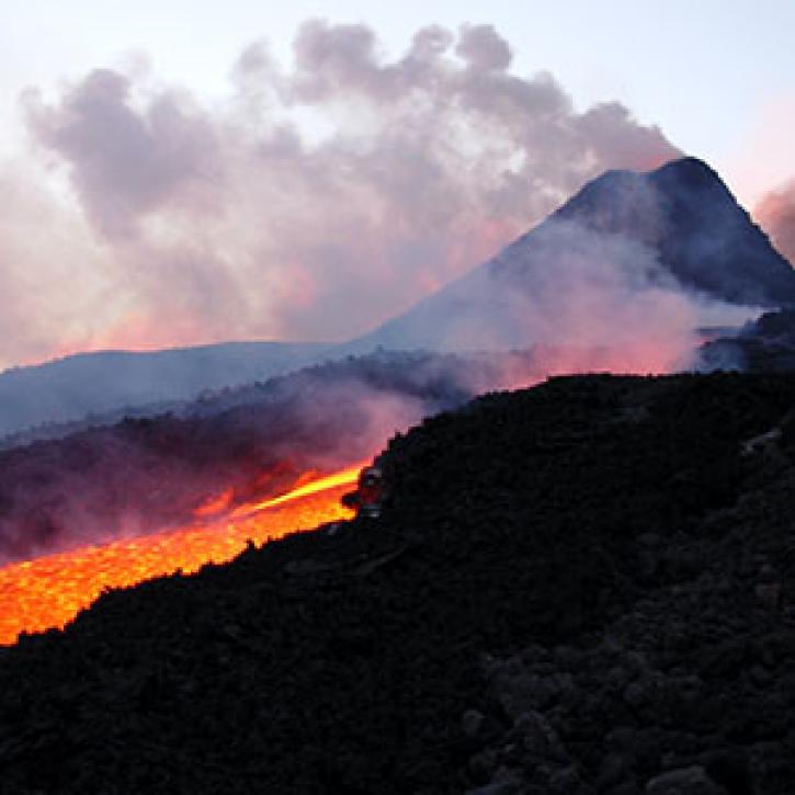
Tracking a volcanic plume reaches new heights, faster.
Feature Article
March 1, 2021

Is the delicate relationship between fire and plants changing?
Feature Article
March 1, 2021

Invasive species cost the U.S. economy approximately $120 billion a year and disrupt the dynamics of ecosystems. Researchers are increasingly using remote sensing to map where invasive species are and where they could spread in order to minimize their damage.
Feature Article
Feb. 25, 2021

Deforestation is taking a toll on the Amazon and other areas of high variability of life. Dr. Eric Bullock uses NASA Earth observation data to explore the consequences of land use and land cover change in these areas.
Data User Story
Feb. 25, 2021
SHOWING 8 OF 285