We are in the process of migrating all NASA Earth science data sites into Earthdata from now until end of 2026. Not all NASA Earth science data and resources will appear here until then. Thank you for your patience as we make this transition.
Read about the Web Unification Project
Human Dimensions News
Articles, resources, and announcements from Human Dimensions.

Colored bands in an interferogram show the gradual sinking of land (subsidence) in Arizona’s McMullen Valley Groundwater Basin between April 2010 and May 2015.
Feature Article
Nov. 4, 2020

The Multi-angle Imaging SpectroRadiometer (MISR) instrument aboard the Terra satellite passed over the Colby Fire at 10:45 a.m. on Jan. 16, 2014, about five hours after the fire was first reported. The instrument was able to acquire images of the fire at different angles, allowing scientists to create a 3-D view of the Colby fire and images of the height of the smoke/particulate dispersal.
Feature Article
Nov. 4, 2020
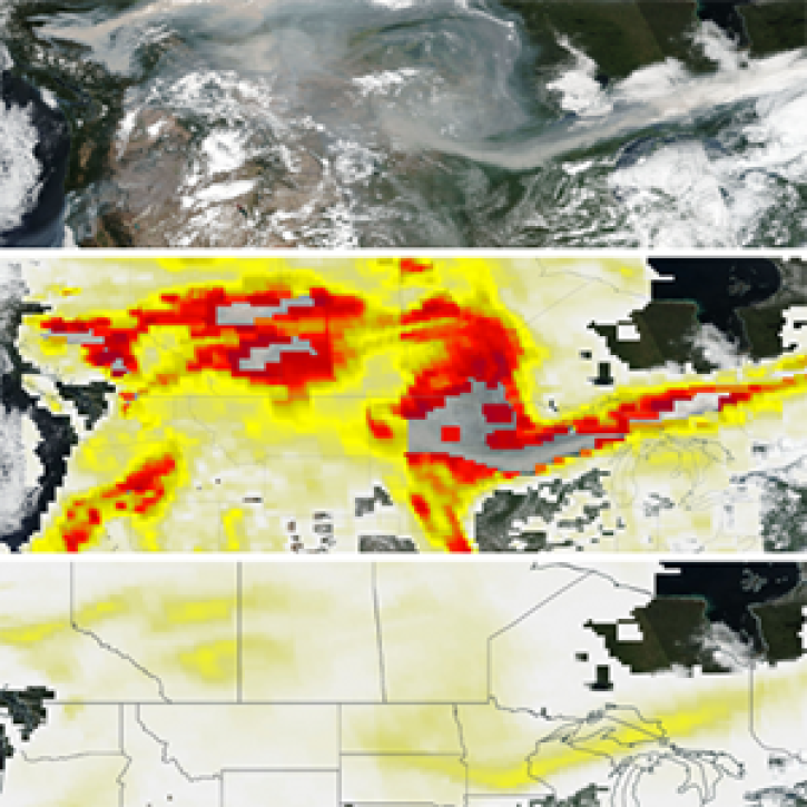
The new PyroCumuloNimbus product for the Ozone Mapping and Profiler Suite (OMPS) makes it easier to track and analyze high concentrations of aerosols from wildfires and similar events.
Feature Article
Nov. 4, 2020

The 16 datasets in the West Africa Coastal Vulnerability Mapping collection provide a wealth of information about the stresses affecting this important region.
Feature Article
Nov. 4, 2020
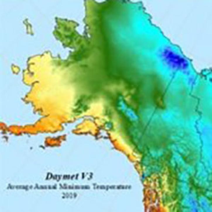
The Daymet dataset at NASA’s Oak Ridge National Laboratory Distributed Active Archive Center (ORNL DAAC) provides nearly 40 years of environmental data about North America.
Feature Article
Nov. 4, 2020
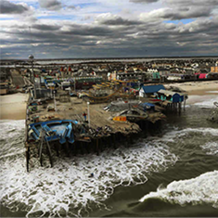
A recent study reviewed the impact of satellite data in accurately forecasting the path of Hurricane Sandy. The study showed that AIRS NRT data from NASA’s polar-orbiting satellites significantly improve these predictions.
Feature Article
Nov. 4, 2020

The most recent GPW update brings new maps and greater utility to SEDAC’s flagship data collection.
News
Nov. 4, 2020

Dr. Don McNeil at Prince of Songkla University in Thailand uses NASA Earth observing data and tools to teach his students about the natural world.
Feature Article
Nov. 4, 2020
SHOWING 8 OF 854