We are in the process of migrating all NASA Earth science data sites into Earthdata from now until end of 2026. Not all NASA Earth science data and resources will appear here until then. Thank you for your patience as we make this transition.
Read about the Web Unification Project
Human Dimensions Learning Resources
Webinars, tutorials, data recipes and more to help you work with Human Dimensions.
Filters

Read highlights of three publications that detail how NASA Earth observation data informs forest structure mapping, disease vector tracking, and mineral identification.
Data in Action
April 26, 2021
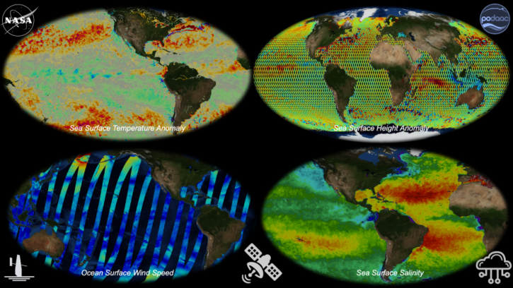
Join us to learn about NASA's archive for physical oceanography data in the context of Open Science. We'll provide you with an introduction to remote sensing and in situ products at PO.DAAC and show you how to work with these data in the cloud.
Webinar
April 22, 2021
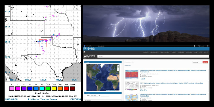
Join us to learn about the importance of lightning observations- for seasonal and long-term trends in lightning activity. We will focus on data and applications from the International Space Station's (ISS) Lightning Imaging Sensor (LIS) instrument.
Webinar
April 20, 2021

This ARSET training focuses on different global population grids and their application to development planning and monitoring of the SDGs.
Training
March 30 - April 6, 2021

Satellite data reveals the oceanic response to the record-setting season.
Data in Action
March 25, 2021

This ARSET training introduces remote sensing observations for monitoring the water level of lakes.
Training
Feb. 9-23, 2021

This ARSET training introduces the use of hyperspectral data to understand critical components of ecosystem dynamics in land and coastal systems.
Training
Ongoing

Learn how MODIS data helped researchers assess the impact of pandemic-triggered lockdowns on air pollution in India.
Data in Action
Jan. 4, 2021
SHOWING 8 OF 332
Frequently Asked Questions
Earthdata Forum
Our online forum provides a space for users to browse thousands of FAQs about research needs, data, and data applications. You can also submit new questions for our experts to answer.
Submit Questions to Earthdata Forumand View Expert Responses