Delivery of Suomi National Polar-orbiting Partnership (Suomi NPP) satellite data products will cease on November 1, 2026. Data users should transition now to alternative products from NOAA-21 and NOAA-20.
Suomi NPP data announcement
Typhoon Surigae near the Philippines
Image captured on 19 April 2021, by the VIIRS instrument, aboard the joint NASA/NOAA NOAA 20 satellite.
Image
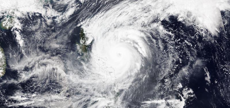
True-color image of Typhoon Surigae moving past the Philippines. This image was acquired on 19 April 2021 by the Visible Infrared Imaging Radiometer Suite (VIIRS), aboard the joint NASA/NOAA NOAA-20 satellite.
On Saturday, 17 April, Super Typhoon Surigae was identified as the strongest tropical cyclone even on record during April in the Northern Hemisphere, with peak winds up to 150mph. A super typhoon is equivalent to a Category 5 hurricane.
Visit Worldview to visualize near real-time imagery from NASA's EOSDIS, and check out more Worldview weekly images in our archive.
Details
Last Updated
Published on
April 27, 2021