The potential consequences reach far beyond the tropics: wetter winters in parts of the southwestern United States, Peru, and Ecuador; drier conditions in Indonesia, Australia, and southern Africa; disrupted fisheries; and higher sea levels that bring coastal flooding and beach erosion along the eastern Pacific coast.
The 2026 event is unfolding on top of decades of ocean warming, so its impacts may be amplified beyond the El Niño signal alone but are not guaranteed. As of September 2026, the U.S. National Oceanic and Atmospheric Administration puts the odds at roughly 75% that this event becomes the strongest El Niño since record-keeping began in 1950.
Using Sentinel-6 Michael Freilich to Watch El Niño
Since 1992, a continuous series of satellite altimeters—including TOPEX/Poseidon, the Jason series, and now Sentinel-6 Michael Freilich and Sentinel-6B—has measured the height of the ocean surface to within a couple of centimeters, mapping nearly the entire globe every 10 days. Each satellite sends radar pulses down to the sea surface and measures how long they take to return, which reveals the height of the ocean below.
That height turns out to be a window into the ocean’s interior. El Niño is, essentially, a rearrangement of the Pacific’s warm water, and warm water is less dense than cold water, so it stands taller. Where the warm surface layer is thick, the sea surface sits higher; where it is thin, the surface sits lower. A rise of just a few centimeters at the surface can signal a warm layer that is many meters deeper.
Sea surface height therefore tracks how much warm water is stored in a region, not just how warm the surface of the ocean feels. This is what makes altimetry so well suited to monitoring El Niño. And because the satellite record has been uninterrupted since 1992, scientists can directly compare 2026 to the strong El Niños of 1997-98 and 2015-16 using the same measurement—a long-term, consistent record that few other Earth observations can match.
Major Findings
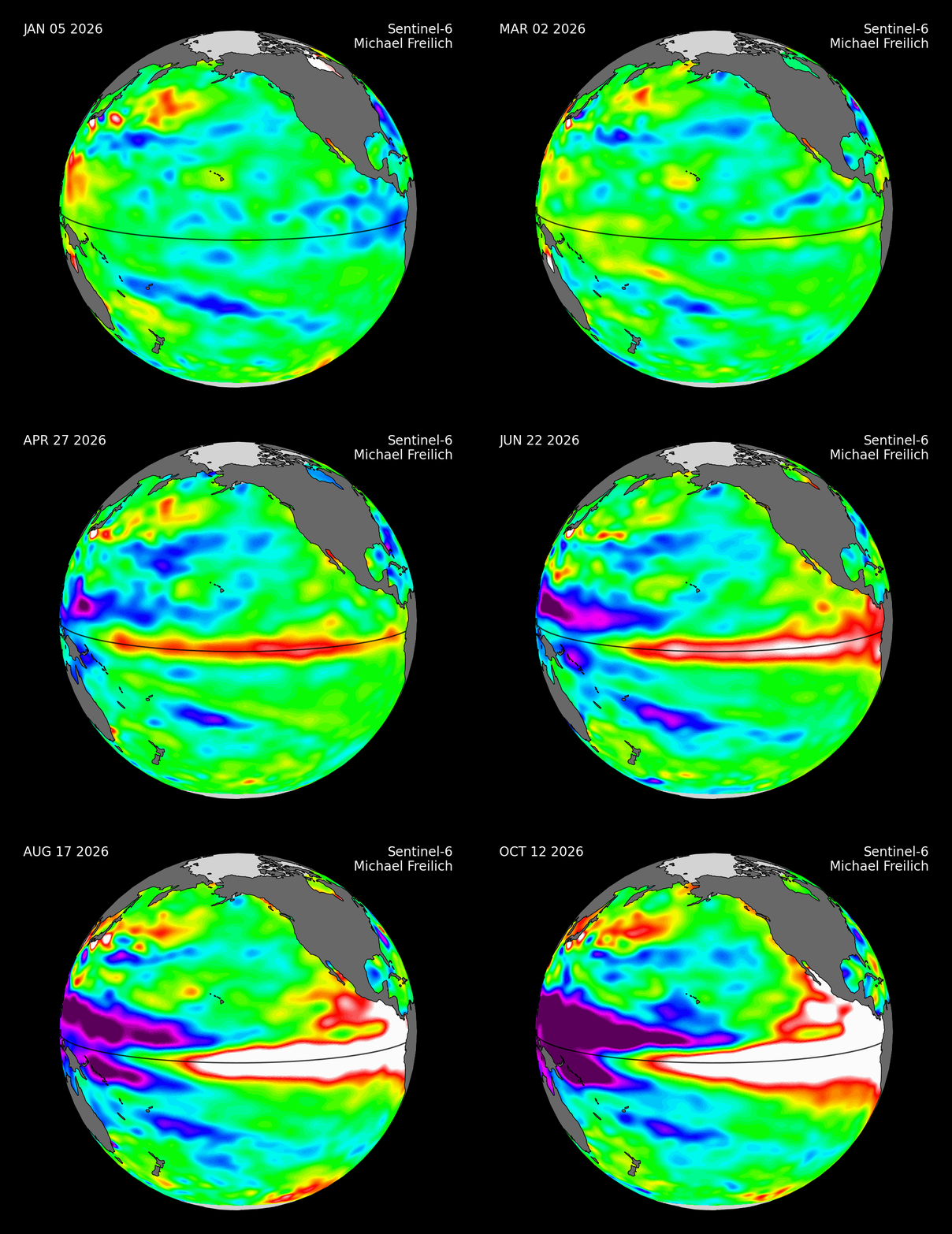
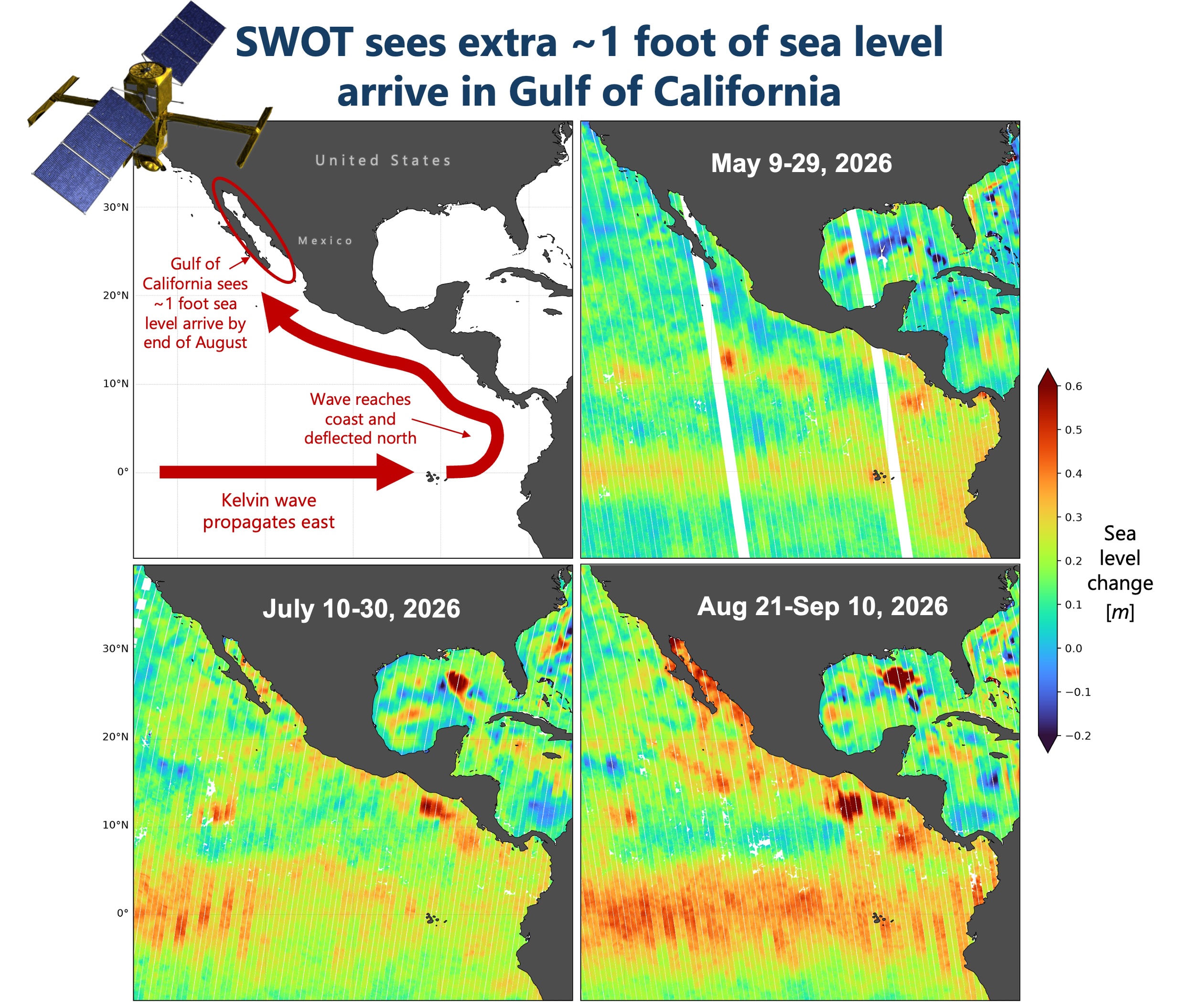
The animation in Figure 1 shows Sentinel-6 Michael Freilich observations of the 2026 El Niño taking shape across the Pacific. Swells of high sea level (red and white) form west of the international date line and travel eastward as Kelvin waves. A Kelvin wave is a wave or disturbance inside the ocean between the warm surface layer and the cold water below. As one passes, the warm layer deepens and the sea surface rises. That disturbance travels east along the equator and takes about two to three months to cross the entire Pacific Ocean.
Compared to 1997 and 2015, this event had a late start and initially lagged behind at the same point in the season. But a series of wind bursts blowing eastward through the summer of 2026 generated new Kelvin waves that helped it catch up.