We are in the process of migrating all NASA Earth science data sites into Earthdata from now until end of 2026. Not all NASA Earth science data and resources will appear here until then. Thank you for your patience as we make this transition.
Read about the Web Unification Project
ODPS SIPS Learning Resources
Webinars, tutorials, data recipes and more to help you work with ODPS SIPS.
Filters
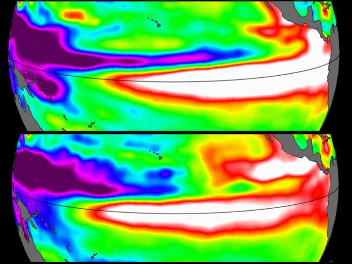
Sea surface height data from the Sentinel-6 Michael Freilich mission reveal complex interactions between the ocean and the atmosphere that affect global weather and climate such as El Niño.
Data in Action
Oct. 31, 2023

SWOT provides high-resolution data to help researchers monitor the vertical transport of heat and carbon within the ocean.
Data in Action
Sept. 15, 2023
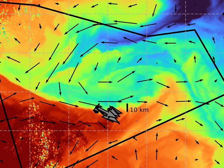
The S-MODE project combined airborne remote sensing and in-situ data to reveal upper-ocean dynamics and small-scale ocean features.
Data in Action
Aug. 29, 2023

This webinar provides a demonstration of using NASA's Catalog of Archived Suborbital Earth Science Investigations (CASEI) for exploring past and present airborne and field campaign platforms, instruments, geophysical concepts, and data products.
Webinar
Aug. 10, 2023

This webinar describes how to set up and use cloud services to run analyses on physical oceanography data at NASA's Physical Oceanography Distributed Active Archive Center (PO.DAAC).
Webinar
Aug. 9, 2023

Satellite data provides indicators of El Niño events.
Data in Action
June 15, 2023

View the agenda and access presentations from the 2023 Ocean Biology and Biogeochemistry Meeting.
Event
May 8, 2023

SHOWING 8 OF 134